1957 U.S. Air Force Aeronautical Chart or Map of Rio Itacaiunas, Para, Brazil
RioItacaiunas-usaf-1957$100.00
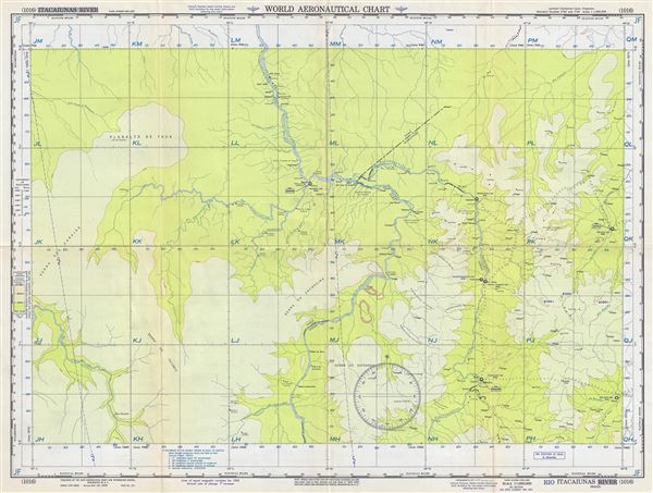

Title
Rio Itacaiunas Brazil.
1957 (dated) 22 x 29 in (55.88 x 73.66 cm) 1 : 1000000
1957 (dated) 22 x 29 in (55.88 x 73.66 cm) 1 : 1000000
Description
This is a fine 1957 U.S. Air Force aeronautical chart or map of the Rio Itacaiunas in the State of Para, Brazil. The map covers the course of the River Itacaiunas along with parts of Rio Araguaia and Rio Tocantins and extends from Balsas to Vila Brabo. The cities of Imperatriz, Carolina, Tocantinopolis, Balsas, Maraba, etc. are noted. The map is highly detailed and notes several rivers, towns, lakes, villages and other hydrographical and topographical features essential for the air pilot. Verso of this chart features legends and a world aeronautical chart index. This chart was published by the USAF Aeronautical Chart and Information Service, and was issued as chart no. 1016. First issued in 1949, this is the fifth edition revised to Feb 1957.
Condition
Very good. Minor wear and toning along original fold lines. Minor spotting.