1953 A to Z Printing Co. Map of Riverside, California
Riverside-atozprinting-1953$250.00

Title
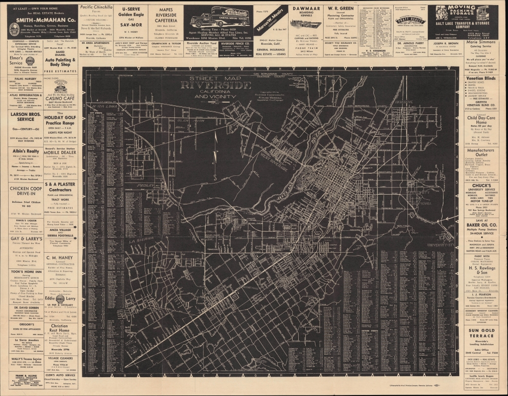
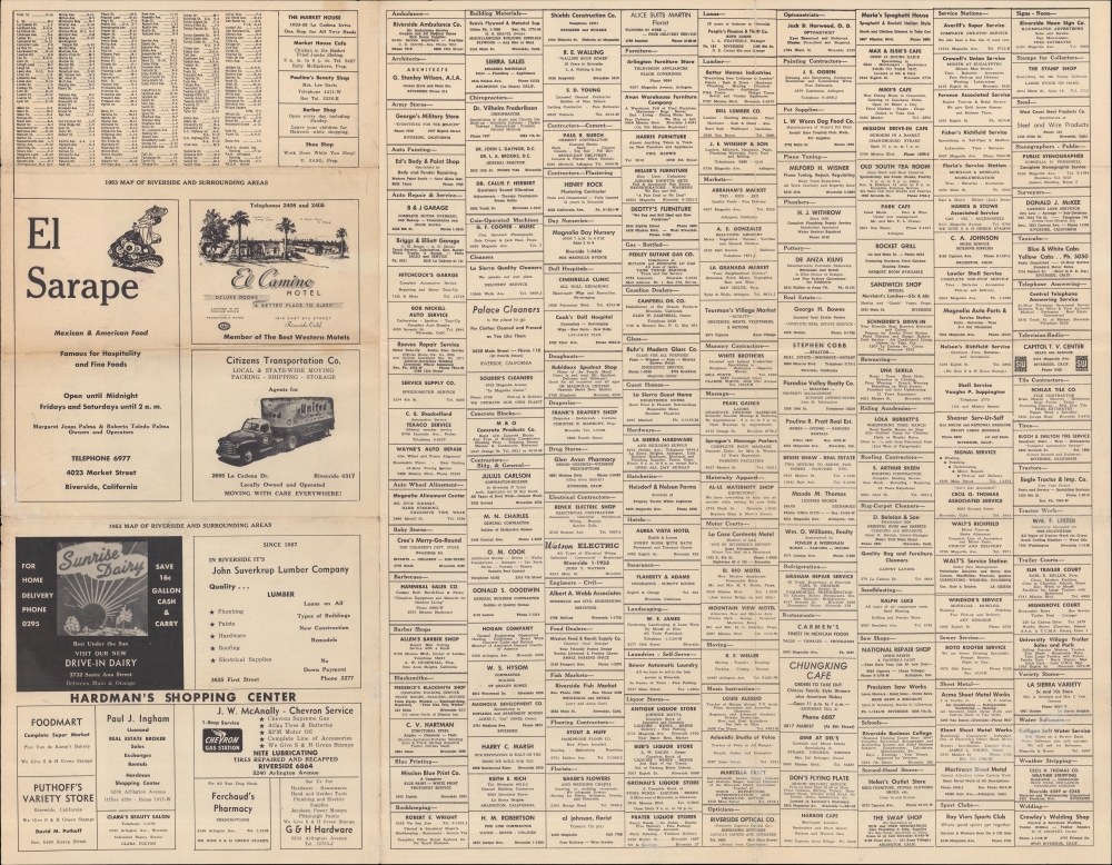
Street Map of Riverside California and Vicinity / 1953 Map of Riverside and Surrounding Areas.
1953 (dated) 21.5 x 27.5 in (54.61 x 69.85 cm) 1 : 34000
1953 (dated) 21.5 x 27.5 in (54.61 x 69.85 cm) 1 : 34000
Description
An intriguing 1953 map of Riverside, California, prepared by civil engineer K. Irving Marshall and printed by the A-to-Z Printing Company. It presents the city in the early phase of a postwar population boom, capped off with a new campus of the University of California, seen here, which opened the following year.
A Closer Look
The map employs an inverted color design, with a black background and streets and other features depicted with white. An alphanumeric grid surrounds the map, corresponding to street indexes to its left and bottom, which continue on the verso. Streets are also labeled on the map, along with neighborhoods, geographic features (including the Santa Ana River, which gives the city its name), rail lines, highways (upgraded to interstates in the following years), and county boundaries. Around the map and on the verso are advertisements for local businesses, reflecting the nature of the local economy, maintaining some of its earlier agriculture focus while also moving into new industries around housing, tourism, and services.The University of California Riverside
This map is perhaps most significant for including an early depiction of the University of California Riverside after it had adopted that name. The University of California established a Citrus Experiment Station in 1907 in what is now the downtown portion of Riverside; a decade later, it moved further east to the current campus. At the turn of the 20th century, Riverside was the center of California's citrus industry, accounting for nearly half of the state's output, making it briefly into the wealthiest city in America per capita. As the population of California boomed in the post-World War II period, the state government recognized the need for additional universities to educate veterans who received subsidized education under the G.I. Bill. Money was earmarked for the campus in 1949, and it officially opened and commenced classes in February 1954.Publication History and Census
This map was prepared by Kenneth Irving Marshall, president of Riverside Engineering, and was printed in 1953 by the A-to-Z Printing Company, also a local firm. The map was published in several editions, but regardless of edition, the OCLC only records examples at the University of California Berkeley (1950 edition), Stanford University (1950 edition), the Library of Congress (1950 and 1953 editions), and the Bibliothèque nationale de France (1955 edition).CartographerS
Kenneth Irving Marshall (fl. c. 1940 - 1965) was a surveyor and civil engineer based in Riverside, California. His early life and training are unclear, but he appears in Riverside city directories starting from the early 1920s. He appears to have worked for the Riverside County Planning Commission in the early-mid 1940s and then founded his own firm, the Riverside Engineering Co., around 1946, producing maps of Riverside (city and county) and other local areas in the Inland Empire. More by this mapmaker...
A-to-Z Printing Company (1921 - present) is a printer based in Southern California. It was founded by Benjamin Eben Dale and was originally based in Riverside. Around 1986, the company moved to Los Angeles and is today based in Irvine. Most of the published works that A-to-Z printed deal with the history and culture of the Inland Empire and other parts of Southern California. Learn More...
Condition
Very good. Light wear along original folds. Several tears along fold lines professionally repaired. Text on verso.
References
OCLC 986509259.