This item has been sold, but you can get on the Waitlist to be notified if another example becomes available, or purchase a digital scan.
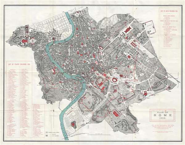
1882 Nelson City Map or Plan of Rome showing Ancient Monuments, Italy
Rome-thomasnelson-1882$187.50

Title
Plan of Rome.
1882 (dated) 21.5 x 28.5 in (54.61 x 72.39 cm) 1 : 9000
1882 (dated) 21.5 x 28.5 in (54.61 x 72.39 cm) 1 : 9000
Description
This is an 1882 Thomas Nelson city map or plan of Rome, Italy, illustrating ancient monuments. The map depicts the city from the Vatican to the Aurelian Wall and from the Villa Borghese and the Piazza del Popolo to the Porta San Sebastiano in the Aurelian Wall along the Appian Way, one of the earliest and strategically most important Roman roads. Incredibly detailed, 175 different locations throughout the city are numerically identified and correspond with an index situated along the left border. Each of these locations is colored red, allowing for easy identification. Numerous other locations throughout the city are labeled, including the Palatine Hill, Circus Maximus, the Colosseum, and the Roman Forum. Myriad streets are also labeled, along with piazzas, parks, and villas. The Tiber River, colored blue, flows through the city.
This map was created by Thomas Nelson and published in 1882.
This map was created by Thomas Nelson and published in 1882.
Condition
Very good. Wear along original fold lines. Verso repairs at some fold intersections. Light foxing. Blank on verso.
References
OCLC 227480743.