1943 Lord Pictorial Map of East Asia and Southwest Pacific during World War II
RouteMacArthur-lord-1943$350.00

Title
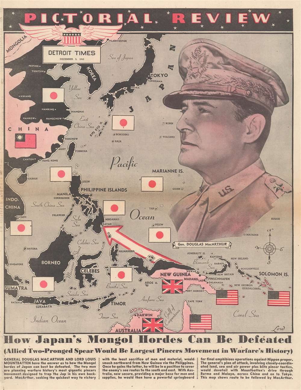
Pictorial Review. How Japan's Mongol Hordes Can Be Defeated.
1943 (dated) 20.75 x 16 in (52.705 x 40.64 cm)
1943 (dated) 20.75 x 16 in (52.705 x 40.64 cm)
Description
This is a 1943 Lord pictorial map of East Asia and the Southwest Pacific during World War II (1939 - 1945). Japanese flags and black ink mark zone of Japanese occupation, including eastern China, Korea, Southeast Asia, the Philippines, and Indonesia. A Chinese Nationalist flag marks China, while British and American flags appear in New Guinea, Australia, and the Solomon Islands. A red and white arrow pierces through the Japanese defensive 'ring' and illustrates General Douglas MacArthur's assault on the Philippines. A large portrait of MacArthur (1880 - 1964) in his trademark khaki uniform overlooking the map dominates the right side of the sheet. Text along the bottom exalts MacArthur and Lord Louis Mountbatten's (1900 - 1979) proposed 'pincer movement' to push the Japanese back to the Home Islands.
Publication History and Census
This map was drawn by a cartographer known only as 'Lord'. It was published in 'Pictorial Review' in several American newspapers, including the Detroit Times, the New York Journal American, and the Chicago Herald American. We note a cataloged example in Persuasive Maps: PJ Mode Collection at Cornell University. This map is not cataloged in OCLC. It appears on the market from time to time.Condition
Very good. Newsprint. Closed margin tears professionally repaired on verso. Text on verso.
References
Cornell University, Persuasive Maps: PJ Mode Collection, 1317.01.