1828 Malte-Brun Map of Russia in Europe
RussiaEurope-maltebrun-1828$100.00

Title
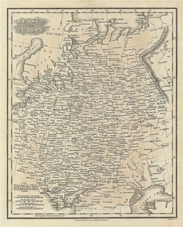
Russia in Europe.
1828 (undated) 10 x 8 in (25.4 x 20.32 cm)
1828 (undated) 10 x 8 in (25.4 x 20.32 cm)
Description
This is an attractive example of the 1828 Malte-Brun map of european Russia. The map covers Russia from Lapland to the Caspian Sea and from the Baltic Sea to the Ural Mountains. In 1825, shortly before this map was drawn, Russian army officers, called the Decembrists, protested against Nicholas I's ascension to the throne. The Decembrists (so named because their revolt started in December), favored Nicholas I's brother, Constantine, who seemed amenable to a British style constitutional monarchy. When Constantine abdicated the throne in 1825, the Decembrists refused to accept the more autocratic rule of Nicholas I. Had Constantine not abdicated and the Decembrists been successful, the bloody Bolshevik Revolution may never have occurred. Various, important rivers, islands, cities and other topographical details are noted. This map was published by Samuel Walker in 1828 as part of the American edition of Conrad Malte-Brun's System of Geography, Vol. I.
Cartographer
Conrad Malte-Brun (August 12, 1755 - December 14, 1826) was an important late 18th and early 19th century Danish / French cartographer and revolutionary. Conrad was born in Thisted, Denmark. His parents encouraged him to a career in the Church, but he instead enrolled in the University of Copenhagen. In the liberal hall of academia Conrad became an ardent supporter of of the French Revolution and the ideals of a free press. Despite the harsh censorship laws of crown prince Frederick VI, Malte-Brun published numerous pamphlets criticizing the Danish government. He was finally charged with defying censorship laws in 1799 and forced to flee to Sweden and ultimately France. Along with colleague Edme Mentelle, Malte-Brun published his first cartographic work, the Géographie mathématique, physique et politique de toutes les parties du monde (6 vols., published between 1803 and 1807). Conrad went on to found Les Annales des Voyages (in 1807) and Les Annales des Voyages, de la Géographie et de l'Histoire (in 1819). He also founded the Paris Société de Géographie . In time, Conrad Malte-Brun became known as one of the finest French cartographers of his time. His son Victor Adolphe Malte-Brun (1816 - July 13, 1889) followed in his footsteps, republishing many of Conrad's original 18th century maps as well as producing numerous maps of his own. The Malte-Brun firm operated well into the 1880s. More by this mapmaker...
Source
Malte-Brun, M., System of Geography, Vol. I. (Boston; S. Walker), 1828.
Condition
Very good. Blank on verso. Original platemark visible. Slight overall toning.