1989 Azchetko Pictorial Map of Saint Augustine, Florida
SaintAugustine-azchetko-1989-2$200.00

Title
Historic Saint Augustine Florida. Founded 1565. Our Nation's Oldest City.
1989 (undated) 31 x 21.25 in (78.74 x 53.975 cm)
1989 (undated) 31 x 21.25 in (78.74 x 53.975 cm)
Description
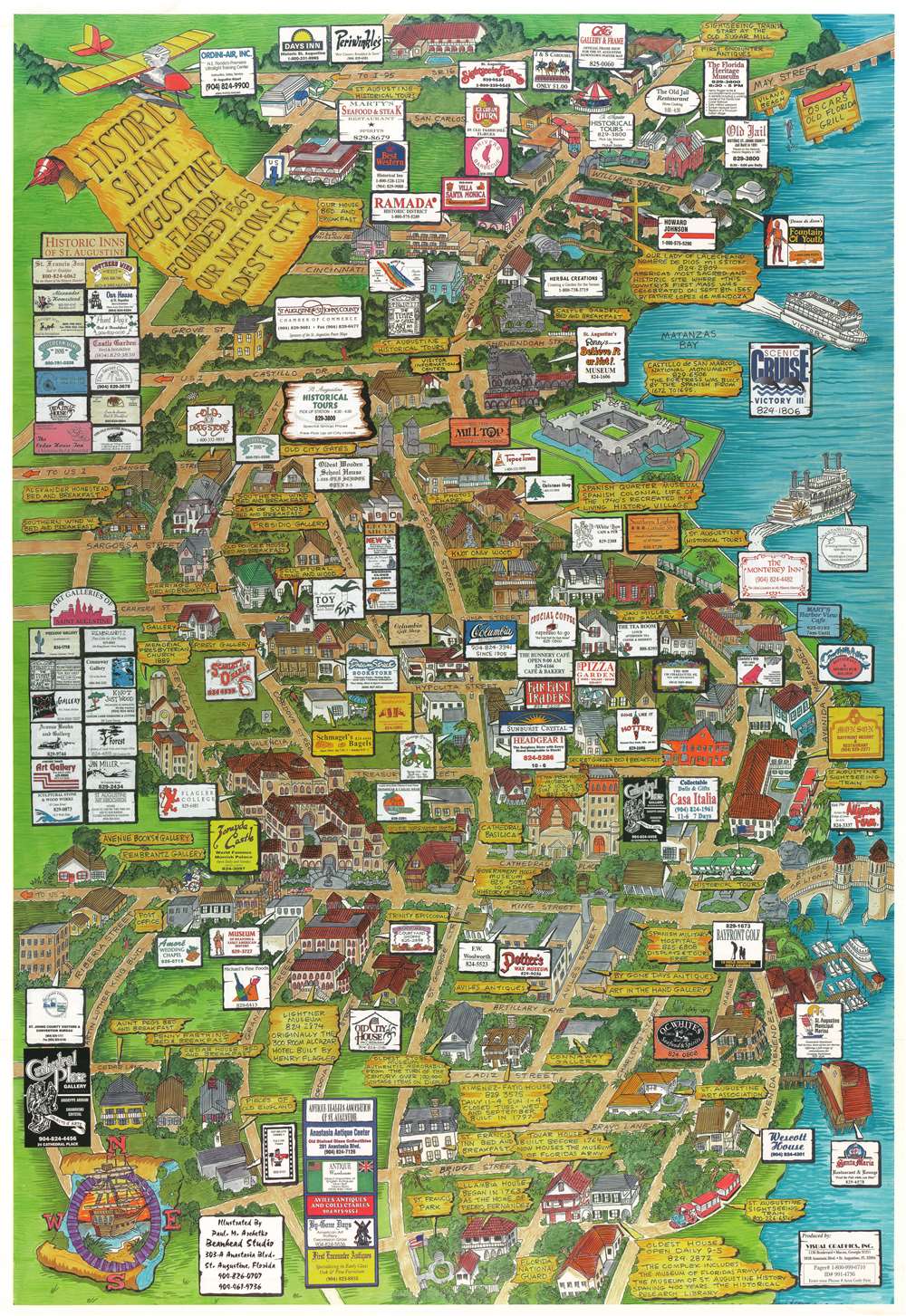
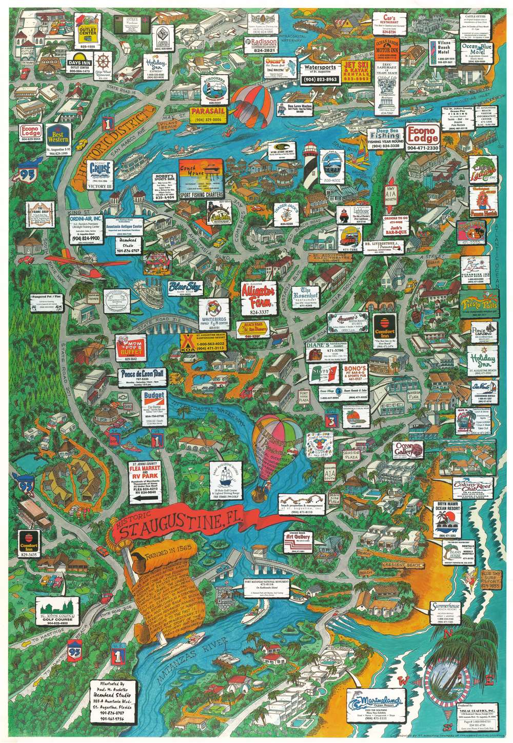
This is a c. 1989 Paul M. Azchetko pictorial map of Saint Augustine, Florida. With maps printed on both recto and verso, this piece provides a detailed look at Saint Augustine’s Historic District as well as a wider view of Saint Augustine.
Historic District
The map detailing Saint Augustine’s historic district focuses on the area between U.S. 1 and Matanzas Bay. Buildings throughout are illustrated, including the Castillo de San Marcos National Monument. Numerous shops, restaurants, hotels, and other businesses are also identified using text boxes that include nearly every business’s phone number. Special text boxes along the left highlight Saint Augustine’s antique dealers, art galleries, and historic inns.Greater Saint Augustine
With the Historic District labeled in the upper left, the map of greater Saint Augustine utilizes many of the same esthetics as the map of the Historic District. Businesses, restaurants, tourist attractions, and other sites are all highlighted, many of which are labeled using colorful business card-like advertisements.Publication History and Census
This map was illustrated by Paul M. Azchetko and published by Visual Graphics, Inc. c. 1989. Not catalogued institutionally.Condition
Very good. Maps printed on both recto and verso.