1845 Ewing Map of South America
SAmerica-ewing-1845$150.00

Title
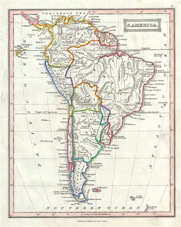
S. America.
1845 (undated) 9.5 x 8 in (24.13 x 20.32 cm) 1 : 37800000
1845 (undated) 9.5 x 8 in (24.13 x 20.32 cm) 1 : 37800000
Description
This is a beautiful example of the 1845 Thomas Ewing map of South America. It covers the entire continent from the Caribbean to Tierra del Fuego and from the Pacific to the Atlantic, including the Falkland Islands. Depicts the continent in impressive detail â€Â' especially the interior, which at the time was largely unknown. Throughout, the map identifies various cities, towns, rivers, mountain passes and an assortment of additional topographical details. Bolivia's claims to the Atacama Desert and Peru's claims to the Tarapaca region - both of which are today part of Chile, are shown.
Much of South America was, at this time, embroiled in or about to become embroiled in, severe civil strife. The new nations, freed from Spanish dominance though various wars of liberation in the previous decades, were struggling with their newfound independence in an attempt create stable and prosperous governments. Most would dissolve into civil war between 1858 and 1864.
This map was published in 1845 by Oliver and Boyd as part of Ewing's New General Atlas.
Source
Oliver and Boyd, Ewing's New General Atlas: containing Distinct Maps of all the Principal States and Kingdoms throughout the World, (Edinburgh) 1845.
Condition
Very good. Minor foxing at places. Blank on verso.