
This item below is out of stock, but another example (left) is available. To view the available item, click "Details."
Details
1915 Munsell Chase City Plan or Map of San Francisco, California
1915 (undated) $400.00
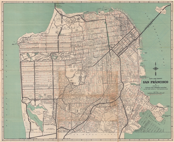
1930 Automobile Association Map of San Francisco
SanFrancisco-automobileassociation-1930$125.00

Title
City and County of San Francisco.
1930 (undated) 21.5 x 26 in (54.61 x 66.04 cm) 1 : 24000
1930 (undated) 21.5 x 26 in (54.61 x 66.04 cm) 1 : 24000
Description
An uncommon map of San Francisco dating to the years just prior to World War II. This map covers all of San Francisco from the Golden Gate to the border with San Mateo County. It shows major and minor roads, parks, and important buildings. The lower right hand corner, where Candlestick Park is now located, was at this point only a proposed landfill, allowing us to date this map to roughly 1930. The landfill was completed over the subsequent 10 years while World War II raged abroad. It was intended as a military base, but with the end of the war, it was no longer necessary. Published by the California State Automobile Association.
Condition
Very good. Some discoloration where originally attached to acidic binder. Original fold lines exhibit minor wear.