This item has been sold, but you can get on the Waitlist to be notified if another example becomes available, or purchase a digital scan.
1906 Candrian Map or Plan of San Francisco and San Mateo, California
SanFrancisco-candrian-1929$225.00

Title
Map of City and County of San Francisco. / Map of San Mateo.
1929 (dated) 22 x 26.25 in (55.88 x 66.675 cm) 1 : 29000
1929 (dated) 22 x 26.25 in (55.88 x 66.675 cm) 1 : 29000
Description
This is an appealing 1929 map of San Francisco and San Mateo, California, by Hermon Anton Candrian and Davenport Bromfield. Candrain published maps from the early 1900s through the 1935s. Although his maps of San Francisco are universally pleasing to the eye and well made, Candrian maps are of greater interest for their verso content, which often feature excellent maps of generally underserved parts of the Bay Area - in this case San Mateo.
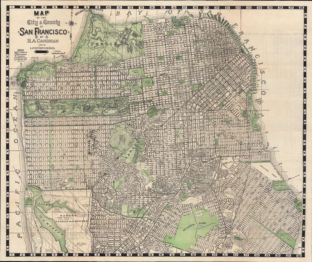
San Francisco
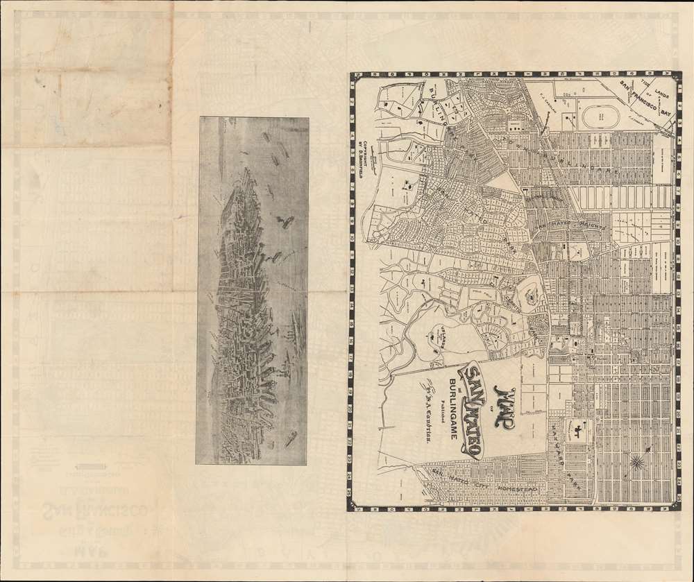
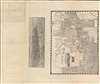
The primary San Francisco map covers from Presidio Park as far south as McLaren Park and the Laguna de la Merced. The map names all major and minor streets as well as trolley lines, lakes, golf courses, piers, municipal buildings, colleges, street cars, railways, fire districts, and military installations. Parks and public areas are highlighted in green. Title and legend in the upper right quadrant. There is a corresponding photographic view of San Francisco on the verso.San Mateo
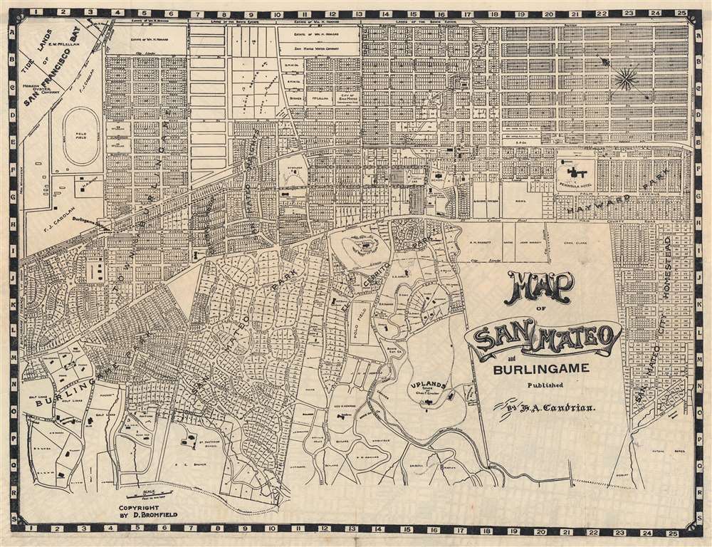
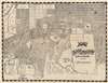
The verso features a smaller map of San Mateo drawn by Davenport Bromfield, former County Surveyor of San Mateo. Although today San Mateo is a bustling community, the heart of Silicon Valley, when this map was issued it was a sleepy suburb of San Francisco. This map is one of the few commercial maps of the period to illustrate the city.Publication History and Census
Candrian published this map from about 1906 to 1935 in various editions. The present map bears the date '1928 - 1929', but this content has been blacked out, suggesting it may be slightly later. Still, we'll go with the blacked-out date in absence of better information.CartographerS
Hermon Anton Candrian (March 28, 1852 - November 28, 1928), commonly publishing as H. A. Candrian, was a Swiss-American map publisher active in San Francisco in the first half of the 20th Century. Candrian was born in Bonaduz, Graubünden, Switzerland. It is unclear when he emigrated to the Untied States, but he working as an insurance agent in Seattle around 1900 and by 1905 had relocated to San Francisco. From at least 1906, his wife, Bertha Wilhemina Candrian (née Harry; 1862 - 1944), drafted many of his maps. Candrian’s works focus heavily and tourist and railway guides to the city of San Francisco and the general Bay Area. More by this mapmaker...
Davenport Bromfield (July 2, 1862 - August 22, 1954) was an Australian Civil Engineer active in San Mateo, California in the first half of the 20th century. Bromfield was born in Warrnambool, Victoria, Australia. He immigrated to the United States in 1870, settling in San Francisco. There he apprenticed as a Civil Engineer. He held the position of Deputy County Surveyor of San Francisco for 2 years before taking a position with the Southern Pacific Railroad. He relocated to San Mateo and was elected San Mateo County Surveyor in 1890. In that position he produced several important large-scale maps of San Mateo County and City. By 1900, he established himself in private enterprise as a Civil Engineer and Surveyor. Davenport remained in San Mateo until his death in 1954. Learn More...
Condition
Good. Some wear along original fold lines. San Mateo map on verso.
References
OCLC 80380557.