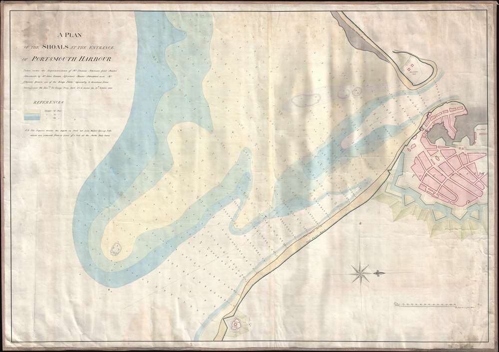
1823 Atkinson Nautical Chart of the Entrance to Portsmouth Harbor, England
ShoalsPortsmouthHarbor-atkinson-1823$400.00


Title
A Plan of the Shoals at the Entrance of Portsmouth Harbor.
1823 (dated) 26.75 x 38 in (67.945 x 96.52 cm) 1 : 3670
1823 (dated) 26.75 x 38 in (67.945 x 96.52 cm) 1 : 3670
Description
This is an extremely rare 1823 Thomas Atkinson nautical chart or maritime map of the entrance to Portsmouth Harbor, England. Oriented toward the west, the map depicts the coastline from the blockhouse fort across the channel from Portsmouth proper to Southsea Castle, with the shoals in the English Channel making up at least three-quarters of the map. Depths in feet at low tide are noted throughout, with shading indicating areas under 10 feet, 14 feet, and 20 feet, respectively.
Census and Publication History
This chart was created from surveys undertaken by Thomas Atkinson, John Osman, and Thomas Brown and published in 1823. This is an exceedingly rare chart, as we have been unable to locate any examples in institutional collections or any known market history.Condition
Very good. Mounted on linen. Some soiling. Blank on verso.