This item has been sold, but you can get on the Waitlist to be notified if another example becomes available.
1957 B.O.A.C. and Chanrai City Plan or Map of Singapore
Singapore-boacchanrai-1957$475.00


Title
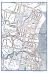
Map of Singapore.
1957 (undated) 17 x 11.25 in (43.18 x 28.575 cm) 1 : 10000
1957 (undated) 17 x 11.25 in (43.18 x 28.575 cm) 1 : 10000
Description
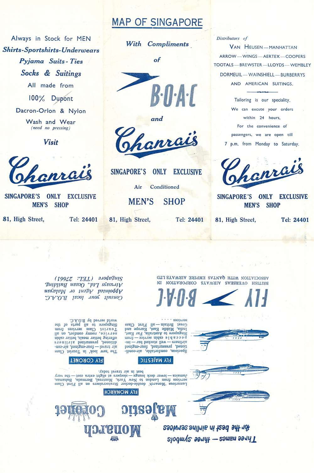
This is a c. 1957 Chanrai's Men's Shop and British Overseas Airways Corporation (B.O.A.C.) map of Singapore. Streets throughout the city are illustrated, although only major streets and avenues are labeled. The Central Fire Station, Fort Canning, King George Park, the Raffles Hotel, and the Clyde Terrace Market are all noted. A further twenty-nine locations are identified numerically and correspond to a table along the right border.
Dating the Map with Aircraft
As this map is undated, but the verso advertisements allow us to assign an approximate date. The B.O.A.C. advertisement includes profiles of three aircraft. The top aircraft, the Boeing Stratocruiser, was part of B.O.A.C.'s fleet until 1959. The second aircraft, the Lockheed Constellation, also retired from B.O.A.C.'s fleet in 1959. The third aircraft is the newest airplane in B.O.A.C.'s fleet, the Douglas DC-7. B.O.A.C. introduced the DC-7 on their North Atlantic routes in January 1957, making that year the earliest that this map would have been published.Publication History and Census
This map was created by the Survey Department of the Government of Singapore and copied for publication by Chanrai's Men's Shop and B.O.A.C. c. 1957. We have been unable to locate any other surviving examples.Condition
Very good. Exhibits light wear along original fold lines. Printed advertisements for Chanrai and B.O.A.C. on verso.