This item has been sold, but you can get on the Waitlist to be notified if another example becomes available, or purchase a digital scan.
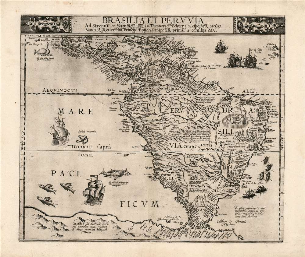
1593 De Jode Map of South America and the Caribbean
SouthAmerica-jode-1593
Title
1593 (undated) 14 x 16.5 in (35.56 x 41.91 cm) 1 : 20800000
Description
El Dorado?
This is the first printed map of South America to show the location of the mythical Lake of El Dorado, printed two years before Sir Walter Raleigh's expedition to Guiana seeking out that place's reputed fabulous riches. The fabled lake is shown here as the source of the Paraguay River, sharing the future supposed location of the similarly-fabledLaguna de Xarayes in the vicinity of the vast Pantanal flood plain. Later missionaries and chroniclers, particularly Díaz de Guzman, imagined an island in this lake but we do not see such an island appear on a map in this region until the Hondius America of 1606. In time, Sir Walter Raleigh's account of the discovery of Guiana (and his assurances that gold could be had there) would take hold and depictions of El Dorado would be associated not with the source of the Paraguay, but with the massive legendary lake Parime in Guyana near the headwaters of the Orinoco River.A Wealth of Descriptive Detail
In addition to the finely-engraved place names throughout the map, De Jode includes Latin descriptions of the people, (noting the seasonal attacks by Brazilian tribes on their neighbors, and the Patagonian giants encountered by Magellan's voyage) and animals, such as the giant Hogfish (whose flesh is said to be very beneficial); the Alois, a fish without scales (which resembles something between a goose and a plesiosaur) a beast with the front part of a fox and the hind part of a monkey; and a beast that neither eats nor drinks but subsists only on wind.Richly Embellished
Cornelis understood that improved detail would be insufficient to challenge Ortelius' place in the market, and anticipated the mapmakers of the Dutch Golden age by including in his maps an abundance of images to better show what the places his maps depicted were like. In addition to illustrations of the beasts and people described on the map, there are figures representing natives - mostly appearing to be warlike, some actively in battle with helmeted conquistadors. The settlement depicted in the region of Brazil, upon closer inspection, proves to be a cannibal scene. The sea is decorated with monsters, flying fish, native war canoes, and sailing ships - some locked in battle.Publication History and Census
This map is rare. It was engraved for inclusion in Cornelius De Jode's Speculum Orbis Terrae which was published in a sole edition of 1593. The map was not reprinted, the plates having been acquired from De Jode's widow by Ortelius' executor, Vrients, and destroyed to remove them from the market. This separate map appears in only 7 listings in OCLC. Perhaps a dozen examples of the Speculum appear in institutional collections.Cartographer
Cornelis de Jode (1568 – October 17, 1600) was an Antwerp cartographer, engraver and publisher, He was the son and heir of Gerard de Jode, also a cartographer and publisher. Cornelis studied science at Academy of Douai, but it can be understood that his main education in the trade was at the hands of his father. On his father's death in 1591, Cornelis de Jode took over the work on his father's atlas, Speculum Orbis Terrarum. This had enjoyed publication in a single edition of 1578, overshadowed by the competition posed by Abraham Ortelius' (1527 - 1598) Theatrum Orbis Terrrum. Cornelis published a second edition, to which he added many updated maps to bring the work up to date with its competition. Despite the improvements brought to the atlas, both aesthetic and geographic, De Jode was unable to break Ortelius' grip on the market and there were no further editions of the atlas. After his death, the engraving plates were sold to Ortelius' executor Johannes Baptista Vrients (1552 - 1612), who was continuing to publish the Theatrum. Vrients would utilize several decorative plates from the Speculum, but the complete work and its maps were not published again - likely they were destroyed by Vrients to keep them from competing with his editions of the i>Theatrum. More by this mapmaker...

