1858 Marmocchi / Poggiali Map of Southern Africa
SouthernAfrica-marmocchi-1858$250.00

Title
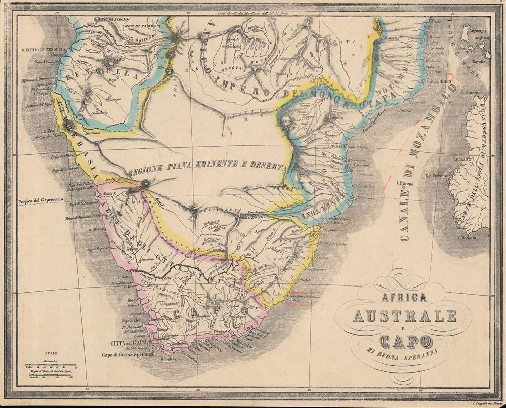
Africa Austale e Capo di Buona Speranza.
1858 (undated) 10.75 x 13 in (27.305 x 33.02 cm) 1 : 11800000
1858 (undated) 10.75 x 13 in (27.305 x 33.02 cm) 1 : 11800000
Description
A nicely hand-colored Italian language map of southern Africa by Francesco Marmocchi, made for his 1858 work Il Globo Atlante di Carte Geografiche. It portrays the region at a time when explorers and European-descended settlers were moving further into the interior, presaging even greater changes in the following decades.
The Dutch Cape Colony came under British control through the upheavals of the French Revolution and Napoleonic Wars, and British actions, such as mandating the use of English and abolishing slavery, exacerbated a trend of settlers moving further and further into the interior. This increased tensions with the indigenous population, which had been greatly weakened by the expansion of the powerful Zulu Empire to the northeast.
Simultaneously, a race was underway to explore the interior of Africa, with David Livingstone and William Oswell crossing the Kalahari Desert in 1849; soon afterwards, Livingstone crossed the continent from west to east. In the years following this map's publication, diamonds and other minerals were discovered in southern Africa, spurring the mining boom that made fortunes and altered the world economy. Additional developments, such as advances in medical and military technology, allowed for the easier expansion of European control into Africa, which increased exponentially in the 1870s and 1880s, setting off the 'Scramble for Africa.'
A Closer Look
Coverage includes the modern-day nations of South Africa, Namibia, Botswana, Mozambique, Angola, Zimbabwe, Zambia, Madagascar, Lesotho, and Eswatini (Swaziland). Mountains, waterways, coastal features, and larger settlements are indicated. The names of regions and major confederations of indigenous people are also noted. Faint traces of hand-written annotations can be seen in the Kalahari Desert and off the eastern coast of the continent.Southern Africa before the 'Scramble for Africa'
This map predates the 'Scramble for Africa' by nearly thirty years, yet the seeds for the later rapid expansion of European imperial control were already being planted. Southern Africa of course differed from most other parts of Africa in that it had a well-established white (Dutch) settler population, dating to the 17th century.The Dutch Cape Colony came under British control through the upheavals of the French Revolution and Napoleonic Wars, and British actions, such as mandating the use of English and abolishing slavery, exacerbated a trend of settlers moving further and further into the interior. This increased tensions with the indigenous population, which had been greatly weakened by the expansion of the powerful Zulu Empire to the northeast.
Simultaneously, a race was underway to explore the interior of Africa, with David Livingstone and William Oswell crossing the Kalahari Desert in 1849; soon afterwards, Livingstone crossed the continent from west to east. In the years following this map's publication, diamonds and other minerals were discovered in southern Africa, spurring the mining boom that made fortunes and altered the world economy. Additional developments, such as advances in medical and military technology, allowed for the easier expansion of European control into Africa, which increased exponentially in the 1870s and 1880s, setting off the 'Scramble for Africa.'
Publication History and Census
This map appeared as Plate No. 8 in Francesco Marmocchi's Il Globo Atlante di Carte Geografiche, published in 1858, the year of Marmocchi's death. The maps in the atlas employ the plates used in his earlier work Geografia Commerciale, including the title of that work on each map, which may explain the close cutting of the margin here. It was engraved by C. Poggiali in Florence and published by Paolo Rivara in Genoa. This map is not independently cataloged in the OCLC and is scarce to the market, while the entire atlas is held by the David Rumsey Historical Map Collection, the Newberry Library, and the National Library of Australia.Cartographer
Francesco Costantino Marmocchi (August 26, 1805 - September 9, 1858) was an Italian geographer. Following in the footsteps of his father, a professor of physics, he began his studies in the natural sciences. He became involved in the Italian nationalist movement and was an associate of Guiseppi Mazzini, leading to his being arrested and briefly imprisoned before being put under house arrest in his hometown of Poggibonsi. He tried to move to Naples under a pseudonym, but was discovered and was forced to leave, settling in Rome. He then focused on publishing, producing translations, original works, and managing a popular broadsheet dedicated to scientific discoveries. More by this mapmaker...
Source
Marmocchi, Francesco C., Il Globo Atlante di Carte Geografiche, (Genoa: Paolo Rivara) 1858.
Condition
Good. Even toning. Impression somewhat faint at top-left and top border. Small area of loss in bottom-right corner. Faint handwritten annotations.
References
Rumsey 12235.009.