1953 All-Year Club Pictorial Tourist Map of Southern California
SouthernCalifornia-allyearclub-1953-2$200.00

Title
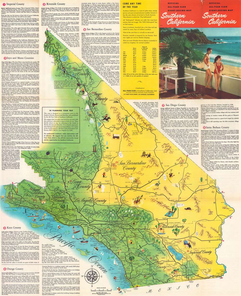
Official All-Year Club Sight-Seeing Map Southern California.
1953 (dated) 27.5 x 22.5 in (69.85 x 57.15 cm) 1 : 576000
1953 (dated) 27.5 x 22.5 in (69.85 x 57.15 cm) 1 : 576000
Description
This is a 1953 All-Year Club of Southern California pictorial tourist map. Coverage extends from Topaz Lake south to the U.S. - Mexico border and from the Pacific Ocean to the California - Nevada border. Pictorial vignettes add charm. Tourists are illustrated sunbathing, fishing, surfing, hiking, and rock climbing, while a rancher, a covered wagon, and a miner reference the region's history. Grapes, oranges, giant sequoias, and cacti highlight the breadth of California's flora. Block texts introduce the region's eight counties, recount history, and highlight places of interest. A yellow box in the upper right includes the All-year Club's pitch that weather in southern California is ideal year-round.
The All-Year Club of Southern California
By the 1910s, Southern California was already a winter destination, a haven for easterners keen to escape New England winters. By the early 1920s, businessmen realized tourism need not be seasonal; Southern California's 'amazing' weather could draw visitors year-round. In 1921, a group of nineteen Southern California businessmen, led by Harry Chandler (publisher of the Los Angeles Times), created the All-Year Club of Southern California as a spin-off of the Los Angeles Chamber of Commerce. The club lobbied the county Board of Supervisors for funding to sell southern California as a summer resort. The push began in Texas, Arizona, and Oklahoma, where residents would see L.A.'s ninety degrees days with low humidity as relief from the sweltering Midwestern summer. That year, a single large resort reported a daily increase of 100 visitors. Likewise, the Santa Fe, Southern Pacific, and Union Pacific railroads reported record ticket sales during the summer of 1921. These early successes were proof of concept for the All-Year Club, and so it expanded promotion. Numbers continued to rise, as did the Club's budget, and by 1926 the All-Year Club was spending $450,000 on advertising and promotional material. However, not everything was positive. Even though SoCal was booming, ads only wanted tourists, not job-seekers. The ads stated categorically that tourists were welcome, but job-seekers were not, since they would not be able to find work. Nonetheless, the hopeful unemployed came, leading to an ongoing population boom. The All-Year Club of Southern California operated under that name until 1968, when it became the Greater Los Angeles Visitors and Convention Bureau, which later merged with the Southern California Visitors Council. Until 2012, the organization had been known as LA Inc., and today it is the Los Angeles Tourism and Convention Board.Publication History and Census
This map was created for and published by the All-Year Club of Southern California in 1953. This map is well represented in institutional collections.Condition
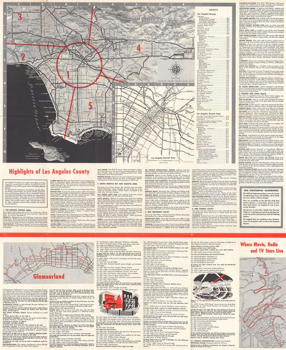
Good. Exhibits light wear along original fold lines. Unrepaired fold separations and slight loss at a few fold intersections because both recto and verso have visual merit. Text and map of Los Angeles County on verso.
References
OCLC 150565292.