This item has been sold, but you can get on the Waitlist to be notified if another example becomes available, or purchase a digital scan.
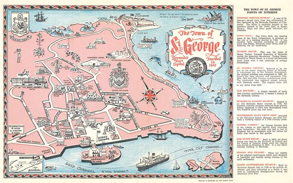
1960 Giles Pictorial Map of St. George, Bermuda
StGeorge-giles-1960$50.00

Title
Pictorial Map of the town of Saint George Bermuda.
1960 (undated) 10.25 x 16.5 in (26.035 x 41.91 cm)
1960 (undated) 10.25 x 16.5 in (26.035 x 41.91 cm)
Description
This is a c. 1960 Ken Giles pictorial map of St. George, Bermuda. The map depicts the city from the Saint George Hotel to Gates Fort and from Fort St. Catherine to Higgs Island. Charmingly illustrated, sites around the city are illustrated by profile vignettes. Several forts are illustrated, as are King's Square, the carriage museum, and the gunpowder cavern.
Publication History
This map was drawn by Ken Giles, printed by The Island Press, and published by the Bank of Bermuda c. 1960.Condition
Very good. Light wear along original fold lines. Text on verso.