This item has been sold, but you can get on the Waitlist to be notified if another example becomes available, or purchase a digital scan.
1938 Willmarth Pictorial Tourist Map of Sun Valley, Idaho and Environs
SunValleyIdaho-willmarth-1938$325.00

Title
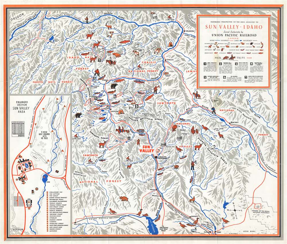
Panoramic Perspective of the Area Adjacent to Sun Valley, Idaho.
1938 (undated) 26.25 x 30.75 in (66.675 x 78.105 cm)
1938 (undated) 26.25 x 30.75 in (66.675 x 78.105 cm)
Description
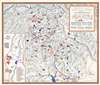
This is a c. 1938 William Willmarth pictorial map of Sun Valley, Idaho and environs issued to promote tourism. Pictorial icons highlight one of the region's iconic natural wonders: its wildlife. Bighorn sheep, elk, bears, bobcats, mountain goats, and mountain lions are represented. Mountains are labeled throughout, underscoring the area's fine alpine skiing. Sun Valley is situated below and to the right of center. A Union Pacific railroad spur leads to the resort, while red lines trace the highway network. An inset in the lower right details the Sun Valley Resort and alphabetically identifies twenty-four locations, including the Challenger Inn, the Sun Valley Lodge, the swimming pools, tennis courts, ice-skating rink, children's playground, golf course, and rodeo arena.
Sun Valley
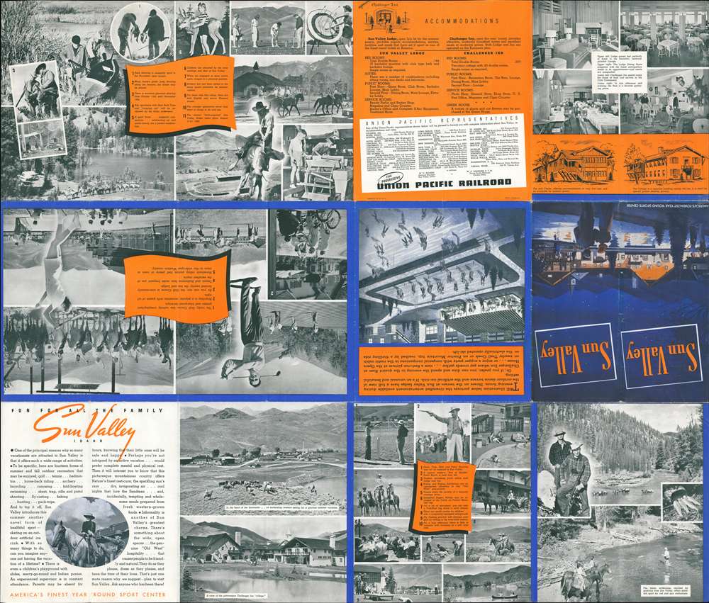
The Sun Valley Resort was founded in 1936 by Union Pacific Railroad Chairman W. Averell Harriman as a way of promoting Union Pacific routes in the American West. Harriman hired renowned Austrian sportsman Count Felix von Schaffgotsch to select the site. Construction was completed in seven months at the cost of $1.5 million. In the fall of 1936, Harriman and Union Pacific installed the world's first chairlifts at Proctor Mountain and Dollar Mountain. They were developed at Union Pacific headquarters in Omaha, Nebraska during the summer of 1936. Today, the term Sun Valley references the entire region.Publication History and Census
This map was drawn by William Willmarth and published by Rand McNally for the Union Pacific Railroad around 1938. There appear to be multiple variants, but none are dated. Two examples are cataloged in OCLC and are part of the collections at the Wisconsin Historical Society and Boise State University. We have encountered two examples in private hands.CartographerS
William Andrew Willmarth (November 20, 1898 - October 3, 1984) was an American artist. Born in Chicago, Illinois, Willmarth served in the armed forces during World War I, possibly with the Merchant Marine. His family moved to Omaha, Nebraska, in 1920, where he worked at the Holland Furnace Company with his older brother Kenneth and his father Philip, who managed the company. The following year, Willmarth and his brother are both listed as commercial artists in the Omaha city directory. The Willmarths continued making commercial art through the 1920s, and William won second prize in a nationwide contest for the best Citizens' Military Training Camps poster in 1926. Throughout these years the majority of their work was signed simply as 'The Willmarths'. The Willmarths first produced work for the Union Pacific Railroad in 1930, when they designed the covers for two Union Pacific brochures promoting Yellowstone National Park. Willmarth began creating work for Union Pacific more regularly beginning in 1932, when two of his posters were selected as winners in a poster contest to promote travel in the western United States. He also designed one of the posters for President Roosevelt's 1934 'National Parks Year' campaign. Beginning in 1936, when the Chairman of the Union Pacific Railroad W. Averell Harriman opened his Sun Valley Resort in Idaho, the Willmarths began creating numerous promotional pieces for the resort, which was publicized as the first destination winter resort in the country. Both Willmarths created maps, posters, and other pieces promoting Sun Valley. During World War II, William and his brother created several pieces for the 'Keep 'Em Rolling' war posters series. Then in 1945, the brothers created a series of eleven paintings for Union Pacific, one for each Western state served by the Union Pacific. Known as the 'Your America' series, these works promoted a Union Pacific sponsored radio show of the same name and appeared as posters and print ads. They were even turned into a calendar and postcards. The Willmarths also created a series of magazine advertisements promoting the Union Pacific Streamliners from 1948 until 1950. William married Julia Morrison in April 1923. The couple had five children, three daughters and two sons. William and Julia moved to Tuscon, Arizona in 1958, where he likely retired from the commercial art business. However, he continued creating art for the rest of his life, even winning the 'color the bus' contest (meant to find a new color scheme for the city's buses) in Tuscon in 1976. Apparently, he entered 'for the fun of it'. Julia passed away on November 12, 1968, and William remarried on September 17, 1969, to Barbara Henderson. More by this mapmaker...
Rand, McNally and Co. (fl. 1856 - present) is an American publisher of maps, atlases and globes. The company was founded in 1856 when William H. Rand, a native of Quincy, Massachusetts, opened a print shop in Chicago. Rand hired the recent Irish immigrant Andrew McNally to assist in the shop giving him a wage of 9 USD per week. The duo landed several important contracts, including the Tribune's (later renamed the Chicago Tribune) printing operation. In 1872, Rand McNally produced its first map, a railroad guide, using a new cost effective printing technique known as wax process engraving. As Chicago developed as a railway hub, the Rand firm, now incorporated as Rand McNally, began producing a wide array of railroad maps and guides. Over time, the firm expanded into atlases, globes, educational material, and general literature. By embracing the wax engraving process, Rand McNally was able to dominate the map and atlas market, pushing more traditional American lithographic publishers like Colton, Johnson, and Mitchell out of business. Eventually Rand McNally opened an annex office in New York City headed by Caleb S. Hammond, whose name is today synonymous with maps and atlases, and who later started his own map company, C. S. Hammond & Co. Both firms remain in business. Learn More...
Condition
Very good. Exhibits wear along original fold lines. Text and printed images on verso.
References
OCLC 19574359. Hornsby, S. J., Picturing America: The Golden Age of Pictorial Maps, plate 108, page 191 (alternate edition).