This item has been sold, but you can get on the Waitlist to be notified if another example becomes available, or purchase a digital scan.
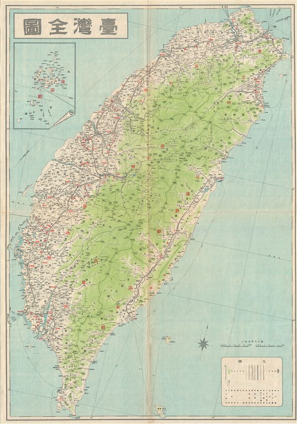
1930s Japanese Map of Taiwan or Formosa
Taiwan-japanese-1930s$150.00

Title
Taiwan.
1930s (undated) 29 x 21 in (73.66 x 53.34 cm)
1930s (undated) 29 x 21 in (73.66 x 53.34 cm)
Description
This is a beautiful c.1930 Japanese map of Taiwan or Formosa. It covers the entire island and notes cities, towns, rivers, roads, railways, shipping lines and a host of additional topographical features. An inset of Penghu County is included in the top left quadrant of the map. Various states of this map were issued throughout the Japanese occupation. All text is in Japanese. Issued by the Japanese in about 1930.
Condition
Very good. Some wear and toning along original fold lines. Some spotting. Professionally flattened and backed with archival tissue.