This item has been sold, but you can get on the Waitlist to be notified if another example becomes available, or purchase a digital scan.
1895 Capital News 'Tokyo Shimbun' Map of Taiwan
TaiwanFormosa-tokyoshimbun-1895$1,250.00

Title
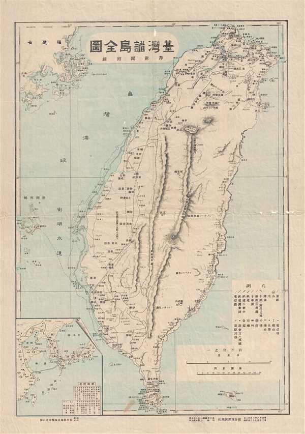
Full Map of Taiwan's Various Islands, Capital News Appendix / 台灣諸島全圖, 都新聞附錄 / Tái Wān Zhū Dǎo Quán Tú, Dū Xīn Wén Fù Lù
1895 (dated) 16 x 11 in (40.64 x 27.94 cm) 1 : 1005000
1895 (dated) 16 x 11 in (40.64 x 27.94 cm) 1 : 1005000
Description
An attractive and historically important early map of Taiwan or Formosa drawn shortly after the island was sized by Japanese forces at the beginning of the First Sino-Japanese War (August 1, 1894 – April 17, 1895). After occupying the Taiwan, the Japanese government quickly dispatched surveyors to properly assess and map their new territory. The maps that immediately followed these surveys were a cartographic attempt to assimilate Taiwan into the expanding Japanese Empire. They also profess to the extreme popular interest among Japanese citizens in the occupied lands. The present map covers the entirety of Taiwan as well as the nearby Pescadores (Penghu Islands) and Fujian Coast (China). Despite large print runs often associated with major Japanese news publishers, in this case Capital News or modern day Tokyo Shimbun, few of this initial wave of Japanese Taiwan maps survive today and are, as a class, quite rare.
Condition
Very good. Wear an a few minor repaired tears, on original fold lines, especially at fold intersections. Else good.