1899 Altura Viu Map of Tarragona Province, Spain
Tarragona-alturaviu-1899$250.00

Title
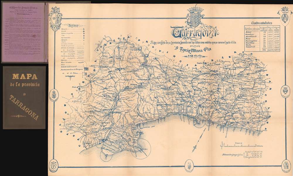
Tarragona. Mapa completo de su provincia formado con los datos mas exactos que se conocer hasta el dia.
1899 (dated) 19 x 27.25 in (48.26 x 69.215 cm) 1 : 250000
1899 (dated) 19 x 27.25 in (48.26 x 69.215 cm) 1 : 250000
Description
This is an 1899 Tomas Altura Viu map of Tarragona Province, Spain. Printed in charming blue ink, the map provides a glimpse into life in this popular Catalan province over one hundred years ago. Roads and railroads are illustrated, and planned railroads, an important sign of progress, are also noted. Towns and villages are labeled, including Tarragona, Montblanch, and Vendrell. Three of the four villages designated at by the Catalan government as 'family holiday destinations', Salou, Cambrils, and Vila-seca, are also highlighted. The Coats of Arms of seven of the region's cities adorn the map's border.
Publication History and Census
This map was created and published by Tomas Altura Viu in 1899. One example is catalogued in the OCLC and it is part of the collection at the Biblioteca Nacional de España in Madrid.Condition
Very good. Light wear and toning along original fold lines. Attached to original binder.
References
OCLC 431350314.