This item has been sold, but you can get on the Waitlist to be notified if another example becomes available, or purchase a digital scan.
1949 Goldschmidt City Map or Plan of Tel Aviv, Israel
TelAviv-goldschmidt-1949$250.00

Title
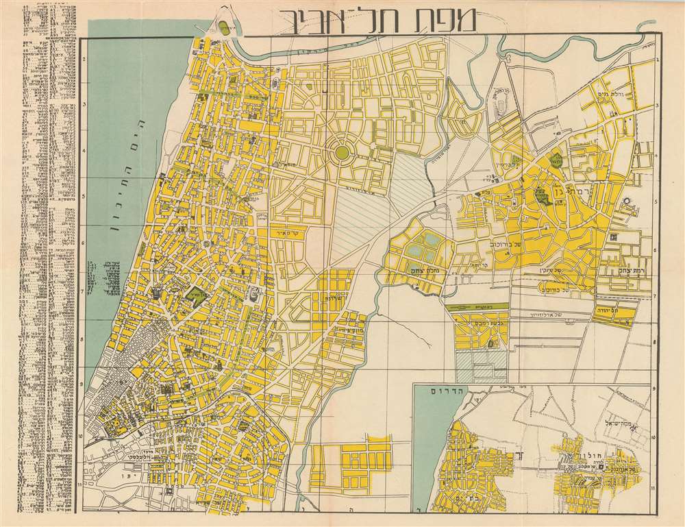
Map of Tel-Aviv. / מפת תל אביב.
1949 (undated) 13.25 x 17 in (33.655 x 43.18 cm) 1 : 17500
1949 (undated) 13.25 x 17 in (33.655 x 43.18 cm) 1 : 17500
Description
This is a 1949 H. Goldschmidt city map or plan of Tel Aviv, Israel in Hebrew. The map depicts the city from the Yarkon River south to Jaffa and from the Mediterranean Sea to Ramat Gan. Highly detailed, myriad streets are illustrated and labeled throughout the city, as are numerous buildings and parks. The Ayalon River is also illustrated. An inset map of the region is situated in the lower left corner, while an index of locations in the city is along the left border.
This map was published by H. Goldschmidt in 1949 from his store at 122 Allenby Street. Today, Allenby Street is a major street in Tel Aviv that serves as a commercial hub during the day and transitions into a center for nightlife after dark, known for its pubs, cafés, and restaurants.
This map was published by H. Goldschmidt in 1949 from his store at 122 Allenby Street. Today, Allenby Street is a major street in Tel Aviv that serves as a commercial hub during the day and transitions into a center for nightlife after dark, known for its pubs, cafés, and restaurants.
Condition
Very good. Even overall toning. Light wear along original fold lines. Blank on verso. Attached to original binder.