1956 Tour Ltd. Map of Tel Aviv, Israel and Vicinity
TelAvivYafo-tourltd-1956$250.00

Title
.תל - אביב - יפו והסביבה / Tel-Aviv-Yafo and Surroundings.
1956 (undated) 26.75 x 12.75 in (67.945 x 32.385 cm) 1 : 28500
1956 (undated) 26.75 x 12.75 in (67.945 x 32.385 cm) 1 : 28500
Description
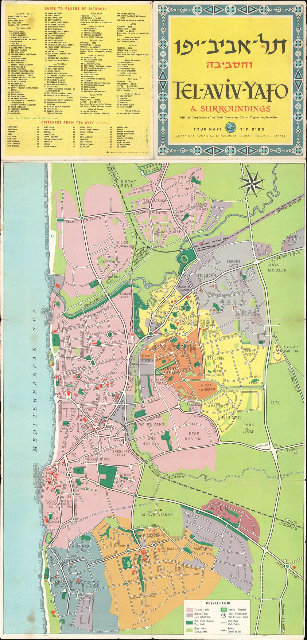
This is a 1956 Tour Ltd. map of Tel Aviv-Yafo, Israel and vicinity. Despite promoting tourism, the map was issued during a time of political unrest, just prior to the outbreak of the Second Arab-Israeli War. The map depicts from the Tel Baruch neighborhood of Tel Aviv south to Holon and Bat Yam. 141 locations throughout the region are numerically identified and correspond with an index situated in the upper left. A bilingual English-French key appears along the bottom and explains the coding.
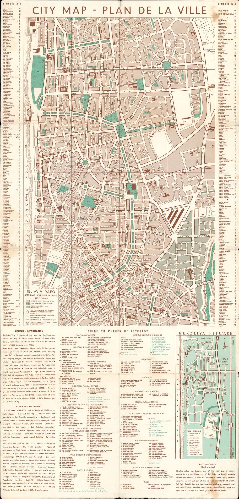
Verso City Map of Tel Aviv-Yafo
A detailed city map of Tel Aviv-Yafo is printed on the verso. 169 locations around the city are illustrated, numerically identified, and correspond with an index situated below the map. An inset of Herzliya Pitu'ach appears below the city plan as well.Publication History and Census
This map was copyrighted by Tour Ltd. and printed by E. Lewin Epstein Ltd. in 1956. An example is part of the institutional collection at the University of Minnesota Minneapolis.Condition
Very good. Exhibits wear along original fold lines. Verso repairs to fold separations. City map of Tel Aviv-Yafo on verso.
References
OCLC 436028267.