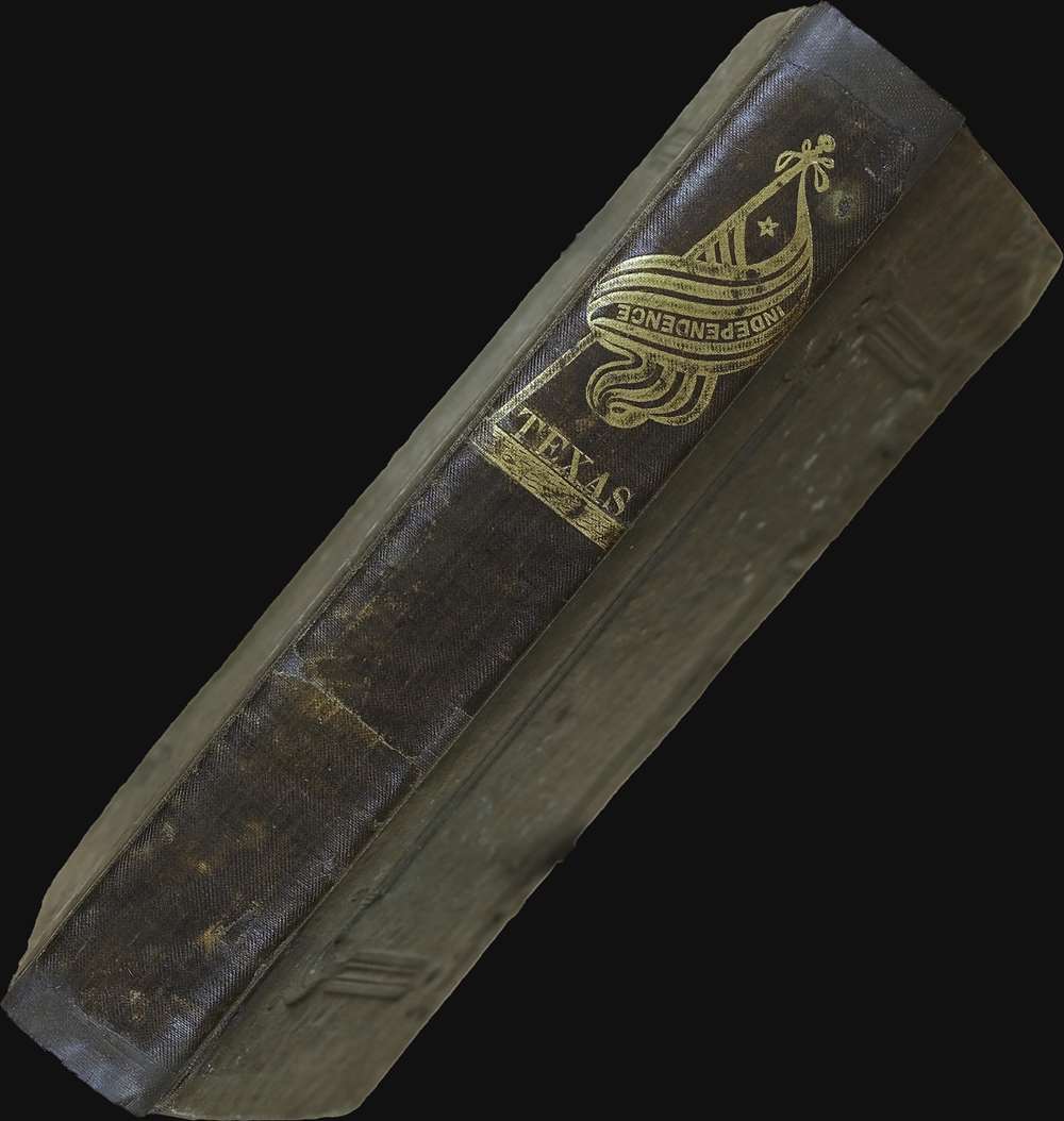
1836 A. A. Parker Narrative of Texan Revolution w/ rare Map of Texas
Texas-parker-1836$7,500.00


Title
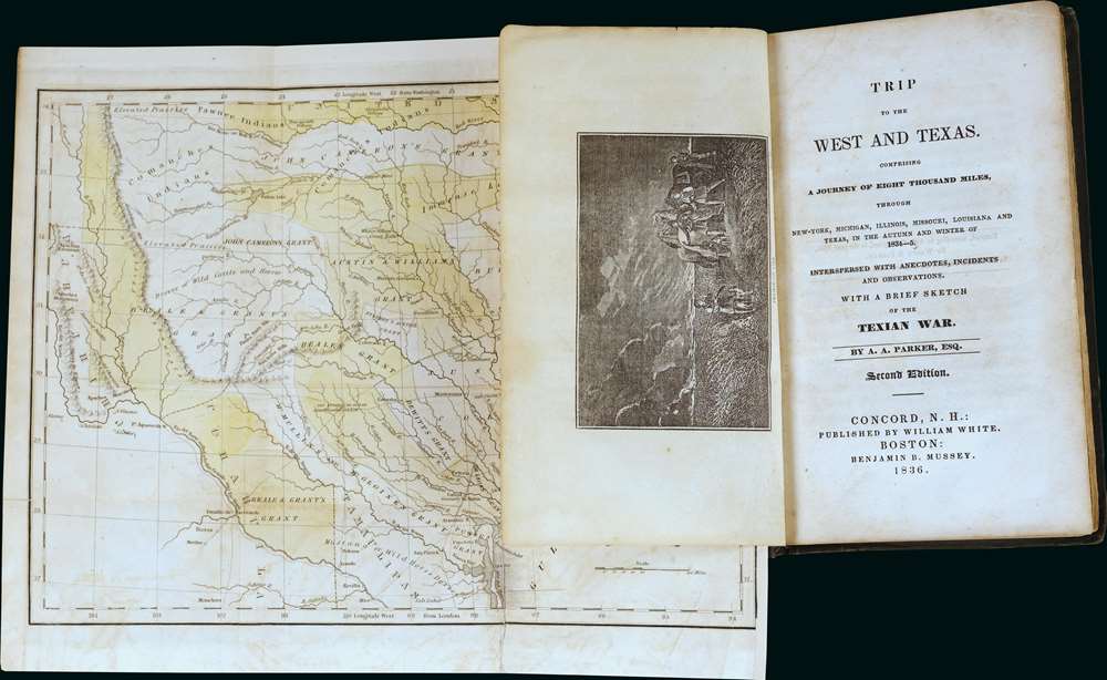
Trip to the West and Texas.
1836 (dated) 8.5 x 10.5 in (21.59 x 26.67 cm) 1 : 4700000
1836 (dated) 8.5 x 10.5 in (21.59 x 26.67 cm) 1 : 4700000
Description
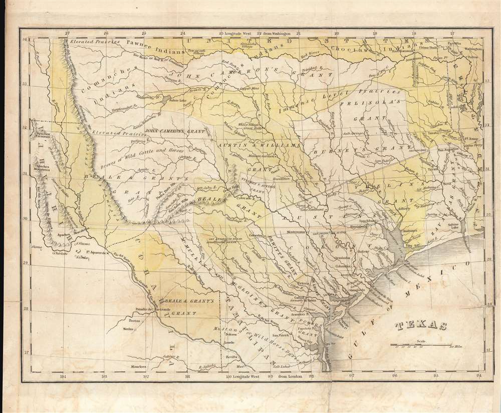
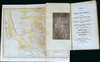
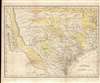
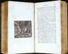
A most significant book and map of Texas, being the 1836 second 'and better' edition of Amos Andrew Parker's Trip to the West and Texas.. This work is considered essential Texana, offering not only one of the earliest maps of the Republic of Texas, but also one of the first illustrations of the Lone Star flag of Texas, and one of the best early descriptions of the Texan Revolution. The map is significant, revealing early land grants throughout the new republic. It also bears an interesting manuscript dedication referencing the Mexican Revolution (1910 - 1920).
As Streeter notes, this map is rare, and appears in only a few examples of the second edition of Parker's narrative. In his own words,
Streeter Describes the Map
Map historian Streeter included a description of this work in his important catalog (1172),This includes a rather pedestrian account of a sightseeing journey of a little over a month in December 1834, from the Sabine to the Colorado, then back to San Felipe and Brazoria. In the account are around forty pages with the caption heading, 'General View of Texas.' The 'Brief Sketch of the Texian War' in the title of the second edition is given in an appendix, which tells the story in popular form to the capture of Santa Anna at San Jacinto. Parker’s entire journey, as outlined on the title page, was to gather information on the regions visited. Even though quite prosaic in style, it has for a little-known new country like Texas the interest that is present in any early contemporary account of travels. Parker, a graduate of the University of Vermont in 1813, was a New Hampshire lawyer and judge, and an occasional author. There is a brief account of him in the General Catalogue of the University of Vermont, Burlington, 1901.
The Map
The present edition bears a small but significant map of Texas closely based on the Bradford map of 1835. Although undated and unattributed, this map too is likely a Bradford, most likely an earlier state. The Bradford map from the atlas embraces slightly more territory to the south. Here Camargo, El Rincon, and Laguna de Santander, which are shown on the atlas map, do not appear, suggesting this is an earlier plate. Another variation, the atlas map features longitude from Washington, while this map bases longitude on the London Prime Meridian - suggesting again that this an earlier plate, possibly intended as a proof for the atlas, not used, then resurrected here.As Streeter notes, this map is rare, and appears in only a few examples of the second edition of Parker's narrative. In his own words,
The map is a rare and variant feature of this second edition. One is fortunate to find a map in this book at all (only five copies of the book have appeared at auction going back to 1975, two lacked the map, and one had only a portion of the map), possibly indicating that the addition of a map to the second edition was an afterthought. The last copy at auction was at Sotheby’s London on November 18, 2004 (Lot 358), where it fetched £6,200 ($11,532). The map is among the early maps of the Republic of Texas in a book, and it is based on Bradford’s 1835 map of Texas published in his atlas (the first Texas map to appear in an atlas). We have seen three different maps with this book: (1) the Dearborn map described in Streeter’s 1172A, (2) an 1836 issue of the important Mitchell-Young map of Texas (see Streeter 1178), and (3) the present map, which is copied very closely from the 1835 Bradford map of Texas.That map was thus a hastily added addendum to the second edition, the publisher incorporating what was obtainable and improvising where necessary. Of the three maps occasionally found in variations of the 2nd edition, the Bradford map alone, as here, does appear to have been issued exclusively for this book.
More on the Bradford Map
Bradford derived this map primarily from the 1830 map of Steven F. Austin, the only readily available source at the time. Austin spent nearly six years compiling data on Texas before publishing his important map in Philadelphia. His intentions with the map were both patriotic and political - Austin wanted to bring Texas colonization to the attention of the American public. Bradford's 1835 map illustrates the success of his efforts. Austin's 1830 map identifies only three Mexican land grants: his primary grant in 1827, his secondary grant entitled 'Austin's Colony,' and De Witt's Grant. Bradford's map, by contrast, illustrates a total of 15 land grants, including those of Williams (and Austin), McMullin and McGloines, Powers, De Deon, Vhelin, Zavalla, Burnet, Beale and Grant, John Cameron, and Felisola. The enormous success of Austin's drive to populate Texas with English speaking settlers eventually led to the disputes that inspired the secession of Texas and ultimately the Mexican American War.Arkansas Boundary Controversy
Another important difference between this map, by Bradford, and Austin's map is the depiction of variant borders relating to the Arkansas Boundary Controversy. The map illustrates two boundaries, the boundary established by the February 28, 1819, Adams-Onis Treaty, roughly where the present day border now stands, and another boundary further west identified as 'Proposed boundary of Arkansas.' This rarely illustrated dispute sprang from confusion by the Arkansas Territorial legislature which, in 1828, established Miller County within the borders of what was then Spanish America. The disputes continued well into the Republic of Texas Period until 1836, one year after this map was made, when Texas created an overlapping Red River County. When Arkansas was formally admitted to the Union as the twenty-fifth state, its borders followed those established in 1819.Republic of Texas
The Republic of Texas was a short-lived nation established in March 1836 when it seceded from Mexico. Following the independence of Mexico from Spain, the American Stephen Fuller Austin led a group of 300 Empresarios to settle Texas, near Austin, where they received a grant from the Mexican government. As more Americans moved to Texas, resentment and strife began to build between the American settlers and Mexican authorities. This and other factors ultimately led to the Texan Revolution in 1835 and the declaration of Texan independence in 1836. Texas remained an independent republic until it joined the United States 10 years later in 1846.Texas Empresario Land Grants
In the early 19th century, Spain instituted a series of reforms intended to settle and develop Texas, the most significant of which occurred in 1820, when it began to allow colonists of any religion (previously they had to be Catholic) to settle. The only colonist to receive land under the Spanish system was Moses Austin (1761 - 1821), who claimed his grant in 1820, only to die a year later in 1821. In that same year, 1821, the Mexican War of Independence (1810 - 1821) ended with Mexican independence from Spain. The new Mexican government continued the reforms, instituting the Texas Empresario system. Stephen F. Austin (1793 - 1836) took over his father Moses's grant and began an aggressive campaign to draw English speaking protestant settlers to Texas. Austin's efforts were aided by the Mexican Provisional Government, who approved the 1824 General Colonization Law authorizing all heads of household who were citizens or immigrants to Mexico to claim land. After the law passed, the government was inundated with requests by foreign speculators to establish colonies - many of whom received grants of their own. In the wake of the Panic of 1819, the United States underwent an extended period of inflation marked by soaring land prices. Texas, with vast tracks of arable land, warm climate, and free grant system, became a very attractive prospect. Austin's drive to populate Texas with English speaking settlers was thus enormously successful. Conflicts between the English protestant 'Emprasarios' and the Catholic Mexican government ultimately led to the secession of Texas and the Mexican American War.Parker
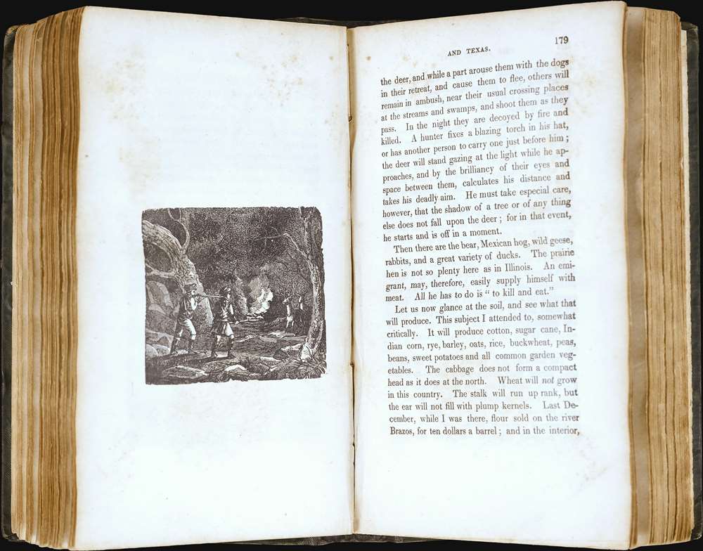
Andrew Amos Parker (1792 - 1893) was a born in Fitzwilliam, Vermont. He studied law at the University of Vermont, eventually becoming a lawyer and a judge. He had his own practice in Epping, New Hampshire, and moved to Concord in 1823 establishing the New Hampshire Statesman. A curious man, Parker traveled west in September 1834, intent on vesting Michigan, Illinois, Missouri, Louisiana, and Texas. As he notes,Although public attention had been for some time directed tither, by various published sketches and frequent emigration, yet so little was definitely known, that I was induced to travel through these sections of the country to learn their actual situation and condition.In the course of his voyage, Parker witnessed Texas on the eve of its revolution, recording faithfully the state of affairs. There are occasional trenchant observations of slavery, including an incident in Texas where a recently re-captured slave begged Parker to help him escape his bondage. Parker also devotes six chapters to an account of his trip through northern and central Illinois with descriptions of the state, and the appendix contains descriptions of other midwestern states. Shortly before the outbreak of violence, he returned to New Hampshire by steamer.
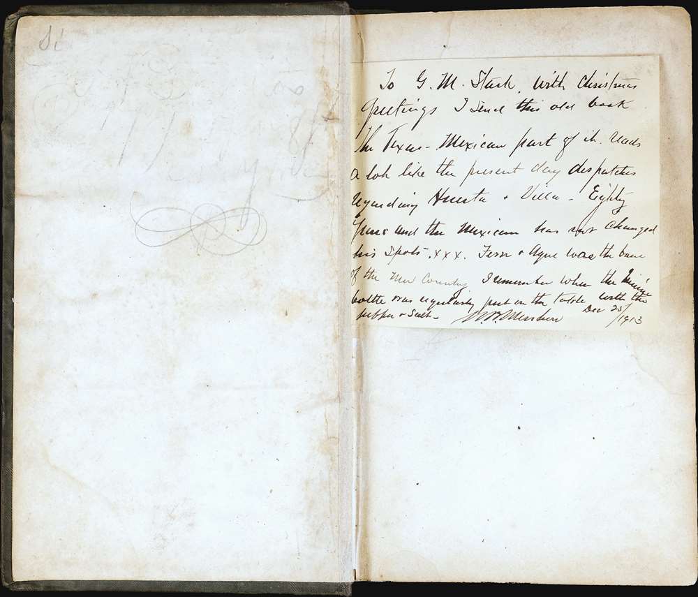
Dedication
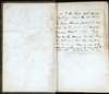
The map bears a pasted dedication and interesting note to one G. M. Stark. We believe this is Gilbert M. Stark, a railroad executive based in Michigan,To G. M. Stark, with Christmas greetings I send this old book. The Texas-Mexican part of it reads a lot like the present day dispatches regarding Huerta and Villa - Eighty years and the Mexican has not changed his spots . xxx. Fever and Ague was the bane of the new Country. I remember when the quinine [?] bottle was regularly put on the table with the pepper and salt. [unreadable signature, W.M. Me??l?on] Dec 25 / 1913.'Fever and Ague' in this case refers to malaria. And the 'dispatches', and troubled times referenced refer to the Mexican Revolution (1910 - 1920).
Publication History and Census
This work was first published in 1835 by William White and Benjamin Mussey in Concord, NH, and Boston, MA, respectively. The present 1836 example is the second edition, revised to include a description of the Texan Revolution as well as an added map. Extremely rare. In addition to the 5 copies noted by Streeter (2 lacking the map) we are aware of 2 others, with a map, that have appeared on the market. The first being the Sloan example in 2007, the second appearing at Arader, with the Young map tipped in.Cartographer
Thomas Gamaliel Bradford (1802 - 1887) was born in Boston, Massachusetts, where he worked as an assistant editor for the Encyclopedia Americana. Bradford's first major cartographic work was his revision and subsequent republishing of an important French geography by Adrian Balbi, Abrege de Geographie published in America as Atlas Designed to Illustrate the Abridgment of Universal Geography, Modern and Ancient. Afterwards Bradford revised and expanded this work into his own important contributions to American cartography, the 1838 An Illustrated Atlas Geographical, Statistical and Historical of the United States and Adjacent Countries. Bradford's cartographic work is significant as among the first to record Texas as an independent nation. In his long career as a map publisher Bradford worked with William Davis Ticknor of Boston, Freeman Hunt of New York, Charles De Silver of Philadelphia, John Hinton, George Washington Boynton, and others. We have been able to discover little of Bradford's personal life. More by this mapmaker...
Condition
Good. Binding tight but restored, retaining original gilt stamped spine and blind-stamped boards. Interior, light foxing. Both plates present. Pencil markings. Manuscript note tipped into front. Library stamp on page 45. Map present but detached. A few minor fold mends, and small repaired tear where originally attached to book. Lower right margin extended. Size noted refers to map. Book 7.5 x 4.75 x 1 inches.