1936 Dallas Morning News Pictorial Tourist Map of Texas
TexasForTourists-dallasmorningnews-1936$500.00

Title
Texas for Tourists.
1936 (dated) 19.75 x 25.125 in (50.165 x 63.8175 cm) 1 : 1854000
1936 (dated) 19.75 x 25.125 in (50.165 x 63.8175 cm) 1 : 1854000
Description
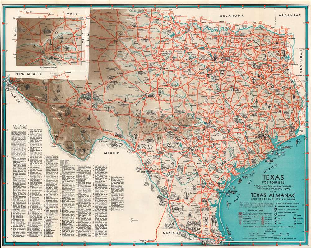
This is a 1936 Dallas Morning News pictorial tourist map of Texas. Pictorial vignettes and icons represent life in Texas (oil drilling, farming, ranching) along with historical sites and cities. Among these are The Alamo in San Antonio and the dome of the State Capitol in Austin. Houston, Dallas, Fort Worth, and Port Arthur are also marked pictorially. Stars inscribed in circles mark historic capitals of Texas, while other icons mark forts, caves, missions, and battlefields. Red lines highlight major roads throughout the state. An inset in the upper left depicts the Texas Panhandle. 267 locations around the state are labeled numerically and correspond with an index situated in the lower left corner.
Railroad Map of Texas
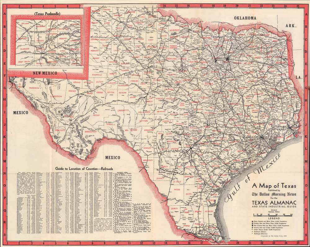
A railroad map of Texas occupies the verso. Black lines trace railroad lines throughout the state, all of which are labeled. Counties are identified and delineated. A county index occupies the lower left corner, along with an index of railway lines that provides the viewer with the full names of all the rail lines only abbreviated on the map.Publication History and Census
This map was created by the Dallas Morning News and published by the Dallas Morning News for the 'Texas Almanac and State Industrial Guide' in 1936. We note a single citation of the separate map in OCLC, at Sam Houston State University in Huntsville, Texas. The guide is cataloged in two dozen institutional collections worldwide.Condition
Very good. Light wear along original fold lines. Light foxing. Verso repair to a fold separation. Road map of Texas on verso.
References
OCLC 73819326.