This item has been sold, but you can get on the Waitlist to be notified if another example becomes available, or purchase a digital scan.
1926 Eaton Pictorial Folding Map of Toronto and Environs
TorontoEnvirons-eaton-1926$150.00

Title
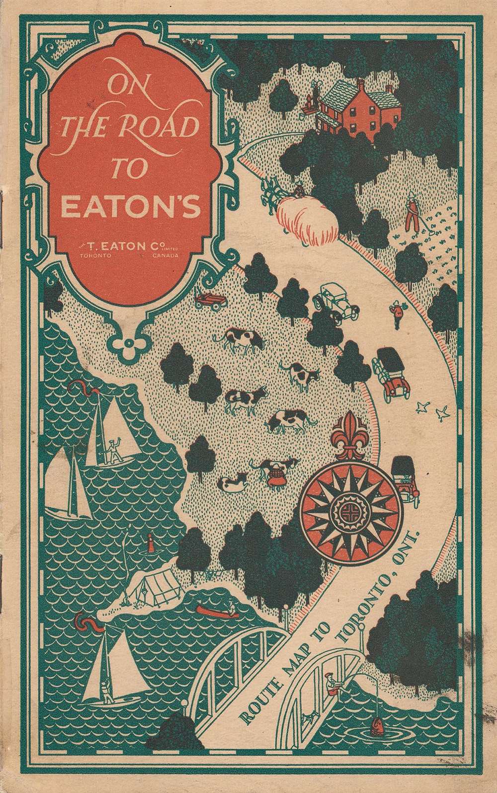
On the Road to Eaton's, Route Map to Toronto, Ont.
1926 (undated) 15.5 x 21 in (39.37 x 53.34 cm) 1 : 1055000
1926 (undated) 15.5 x 21 in (39.37 x 53.34 cm) 1 : 1055000
Description
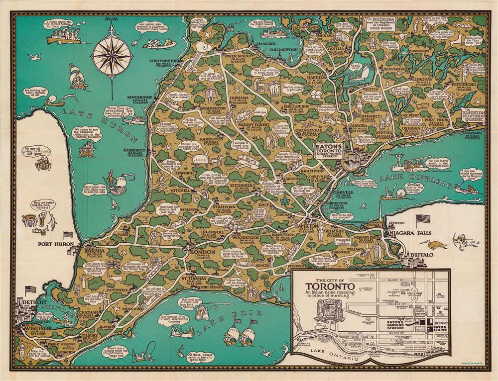
This is a c. 1926 pictorial folding map of the area around Toronto, Canada published by T. Eaton Co., a popular local department store. It shows the southern portion of Ontario, highlighting roads to Toronto and Eaton's main store.
At bottom-right is an inset map of downtown Toronto near Eaton's flagship store at Queen and Yonge Streets. Established in 1883 by Timothy Eaton, the store was a resounding success and employed clever methods (such as this map) to draw customers. Eaton's store had huge plate-glass windows, an impressive light shaft that allowed natural light to fill the store, the first electric lights, the first elevator, and one of the first telephones of any retail establishment in Toronto.
As Eaton owned most of the land surrounding the store, the entire neighborhood save for City Hall and a nearby church was eventually dedicated to Eaton's stores, factories, and warehouses. In the 1960s, Eaton's planned to renovate the entire complex to build a large shopping center. After encountering opposition and modifying the original plans (which called for the destruction of the by-then abandoned City Hall and the church), The Eaton Centre (now Toronto Eaton Centre) opened in 1977 and has operated as a shopping mall ever since, retaining its name even after Eaton's itself went bankrupt in 1999.
A Closer Look
This map contains whimsical cartoon drawings throughout, commenting on the distances tourists and shoppers were willing to travel to shop Eaton's. The comment bubbles mostly refer to the store itself, other local attractions (hunting and fishing), and basic facts about Canada. Special attention is given to shoppers from the United States, who would cross into Canada at either Detroit, Port Huron, or Niagara Falls. The artist of this map is unnamed but refers to himself as 'S.F.T.' in an illustration at top-center, where he answers the inquiry of two passersby by saying 'Yes I am drawing a road map for Eaton's.'At bottom-right is an inset map of downtown Toronto near Eaton's flagship store at Queen and Yonge Streets. Established in 1883 by Timothy Eaton, the store was a resounding success and employed clever methods (such as this map) to draw customers. Eaton's store had huge plate-glass windows, an impressive light shaft that allowed natural light to fill the store, the first electric lights, the first elevator, and one of the first telephones of any retail establishment in Toronto.
As Eaton owned most of the land surrounding the store, the entire neighborhood save for City Hall and a nearby church was eventually dedicated to Eaton's stores, factories, and warehouses. In the 1960s, Eaton's planned to renovate the entire complex to build a large shopping center. After encountering opposition and modifying the original plans (which called for the destruction of the by-then abandoned City Hall and the church), The Eaton Centre (now Toronto Eaton Centre) opened in 1977 and has operated as a shopping mall ever since, retaining its name even after Eaton's itself went bankrupt in 1999.
Publication History and Census
This map was published by Eaton's, a Toronto-based department store known for using pictorial maps in advertising. The store produced route maps of this sort from the 1920s into the 1950s. This is an early edition of their advertising road or route map to Toronto, with the closest known edition being a 1928 publication titled On the road to Eaton's: the greatest store within the British Empire (OCLC 83579985). This edition is not known to be held by any institution and is very scarce to the market.Condition
Very good. Some wear at fold intersections.