This item has been sold, but you can get on the Waitlist to be notified if another example becomes available, or purchase a digital scan.
1921 Labouche Freres City Map or Plan of Toulouse, France
Toulouse-labouche-1921$100.00

Title
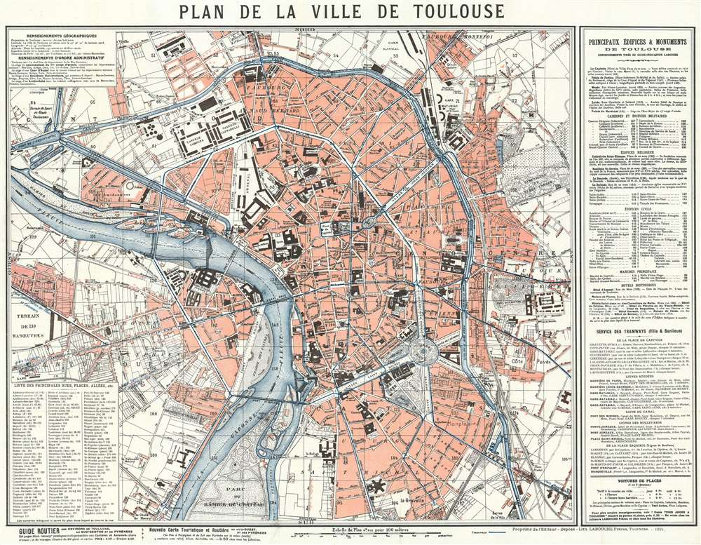
Plan de la Ville de Toulouse.
1921 (dated) 18.5 x 23.75 in (46.99 x 60.325 cm) 1 : 9200
1921 (dated) 18.5 x 23.75 in (46.99 x 60.325 cm) 1 : 9200
Description
This is a 1921 Labouche Frères city map or plan of Toulouse, France. The map depicts the city from the Gare de Toulouse to the Cimetière de Terre Cabade and from the Gare Raynal to the Parc du Ramier du Chateau, which is most likely where the Stade TFC is situated today. Myriad buildings are labeled throughout, such as train stations, churches, government buildings, and schools. Roads, town squares, and parks are also identified. Town districts are noted. An index of major buildings throughout the city, including churches, military posts, City Hall, the town markets, and historic buildings, is situated along the right border, while a street index is included in the lower left corner. Both maps give the location of each site relative to its location on the map's grid, since the entire map is divided up into a grid and each square is assigned a number. That way the viewer can locate anywhere that they want to go.
Publication History and Census
This map was created and published by Labouche Frères in 1921 in Toulouse. We have been unable to locate any other known examples of the 1921 edition, but examples of the 1923 edition are part of the collection at the Bibliothèque Nationale de France and the University of Basel.Cartographer
Server Error
404
Page Not Found
This page either doesn't exist, or it moved somewhere else.
That's what you can do
Condition
Very good. Even overall toning. Light wear along original fold lines. Blank on verso.
References
OCLC 903187967 (1923 edition).