This item has been sold, but you can get on the Waitlist to be notified if another example becomes available, or purchase a digital scan.
1920 Bo Wen Tang Map of Tsingtao or Qingdao, Shandong, China
Tsingdao-bowentang-1920$750.00

Title
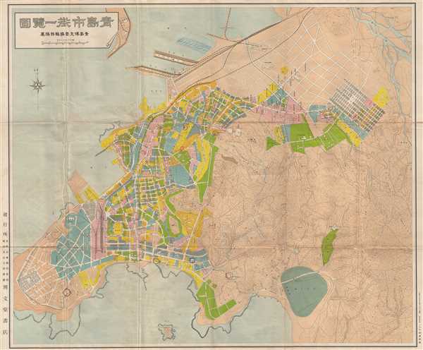
Qīng Dǎo Shì Jiē Yī Lǎn Tú / 青島市街一覽圖 / A View of Qingdao's Streets at A Glance
1920 (undated) 30 x 36 in (76.2 x 91.44 cm) 1 : 4000
1920 (undated) 30 x 36 in (76.2 x 91.44 cm) 1 : 4000
Description
An impressive large format c. 1920 street plan or map of Tsingtao or Qingdao (青岛), Shandong, China. This map was issued by Bo Wen Hall (博文堂), a Japanese operated printing house active in Tsingtao. It was printed shortly after the 1914 seizure of Tsingdao by Japanese forces but before the 1922 return to Chinese rule. The map identifies streets, parks, municipal buildings, hospitals, schools, and public areas. The pier, Zhan Qiao is noted. Also of note is this island of Xiao Qingdao (Little Qingdao), with its iconic lighthouse rendered pictorially.
Condition
Very good. Some wear on original fold lines with slight loss at fold intersections.