This item has been sold, but you can get on the Waitlist to be notified if another example becomes available.
1829 Weiss HUGE Map of Southeastern Europe, Greece, the Balkans, Bulgaria
TurkeyEurope-weiss-1829$3,000.00

Title
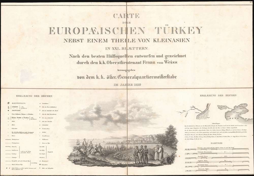
Carte der Europaeischen Tuerkey nebst einem Theile von Kleinasien in XXI. Blattern.
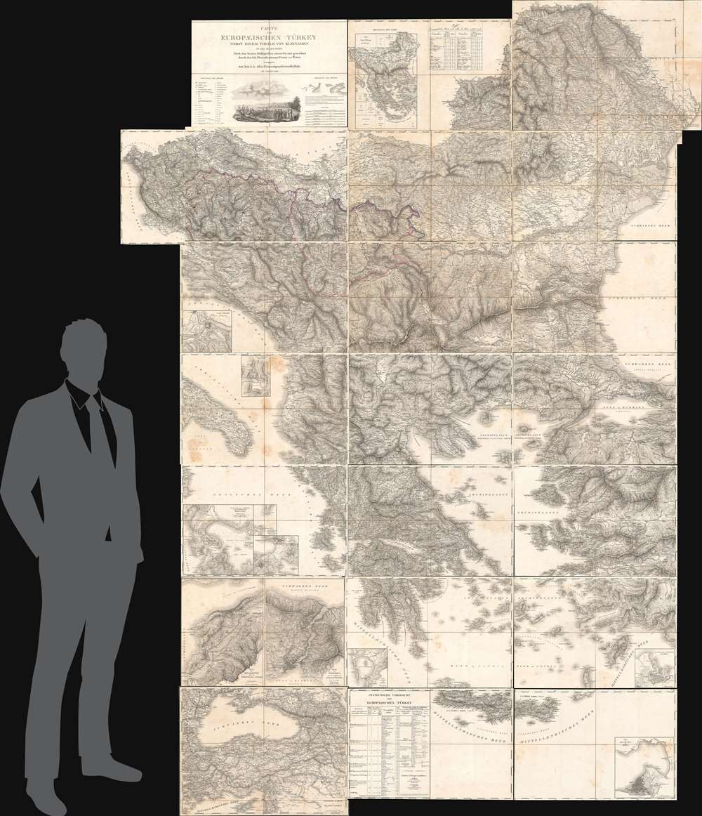
1829 (dated) 118 x 75 in (299.72 x 190.5 cm) 1 : 575000
1829 (dated) 118 x 75 in (299.72 x 190.5 cm) 1 : 575000
Description
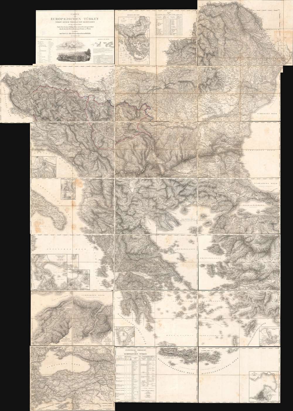
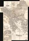
A monumental composite map of European Turkey consisting of 21 linen-backed sheets contained within its original handsome box. This 1829 Franz von Weiss map of 'European Turkey' (Greece, the Balkans, Bulgaria), produced under the auspices of the Austrian military. It is an extraordinary work of military intelligence, made just as the Ottoman Empire's European holdings were collapsing and neighboring powers, including Austria, sought to craft a reaction.
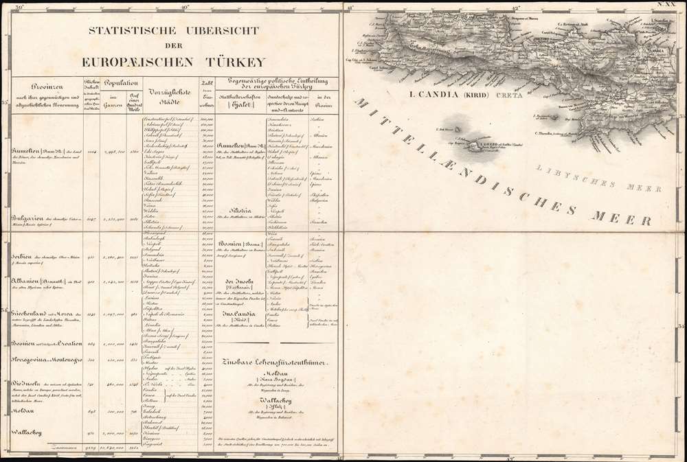
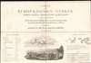
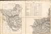
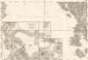
The title sheet at top-left includes a legend with an explanation of symbols and abbreviations used, as well as six scales: German or geographic miles, Turkish 'Reisestunden' (most likely the fersah فرسخ of about 3.5 miles or about ¾ of a German mile), Russian versts, English miles, French leagues, and Italian miles. Klafter (around six feet) are also used in some of the inset maps. The title sheet also has a vignette illustration showing Ottoman troops resting outside a settlement, with the Bosporus in the background.
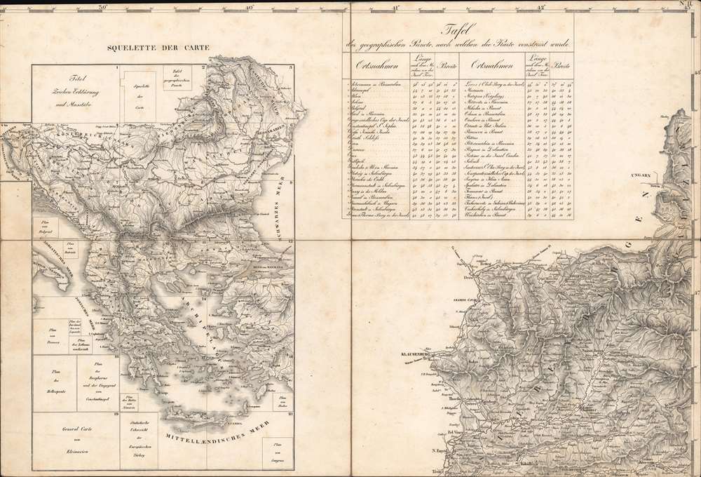
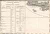
The sheet to the immediate right of the title sheet includes a miniature schematic (squelette) of the entire map, with the proper location of each sheet, and a table with precise longitude (using the Ferro Meridian) and latitude coordinates of important cities and geographic points.
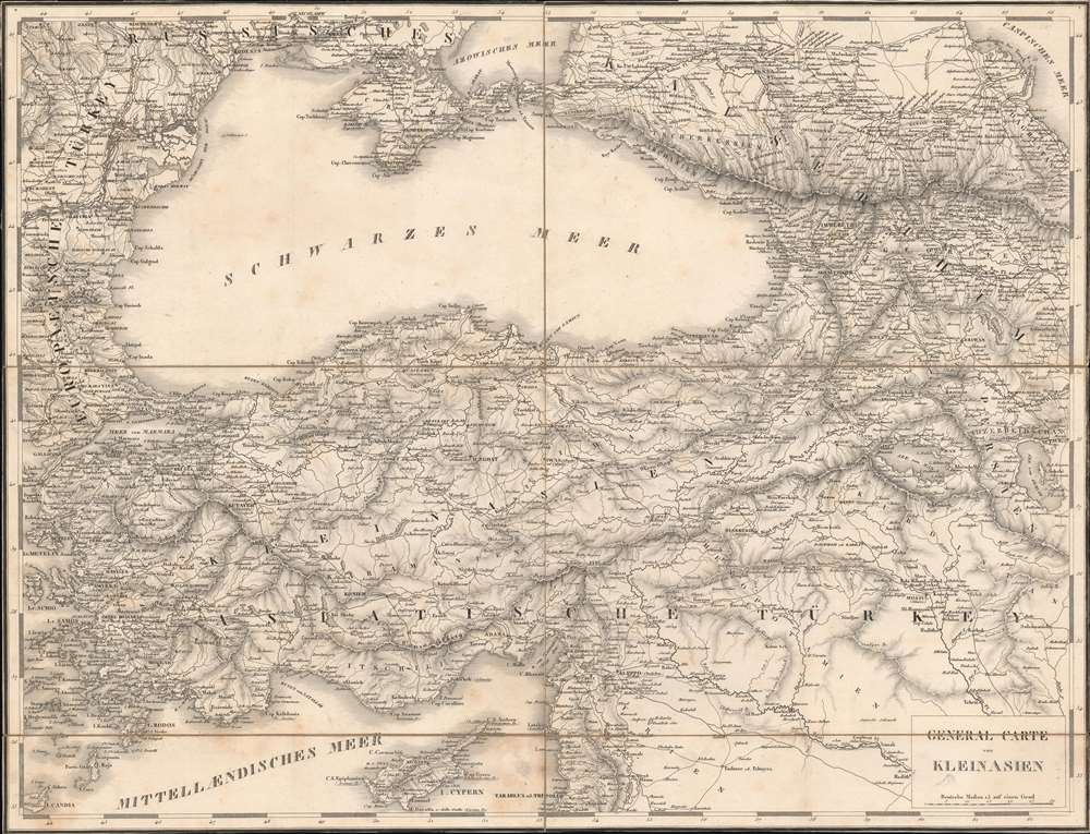
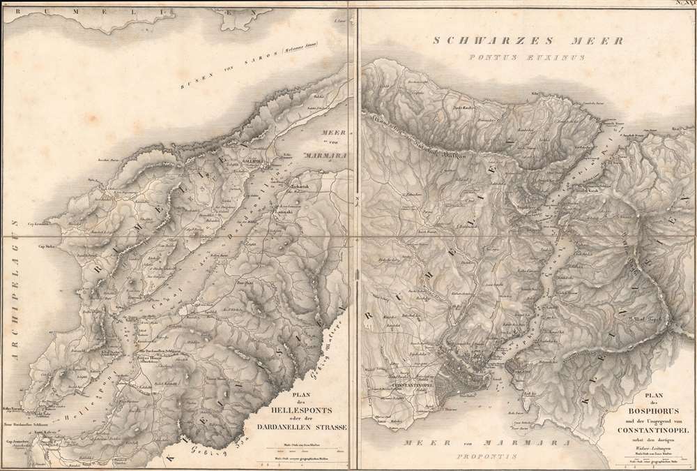
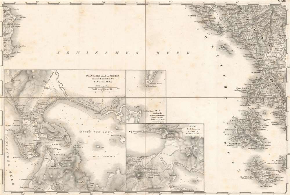
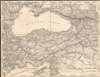
Eleven inset maps appear. They are, clockwise from bottom-right: Rhodes, Smyrna, Navarino Bay (Pylos), Asia Minor, the Bosporus Strait, the Dardanelles (Hellenspont), the Isthmus of Corinth, Lepanto (Nafpaktos), Prevesa (Preveza), Butrint (Butrinto), and Belgrade.
The statistical table at bottom lists the provinces of 'European Turkey' with their area (in German miles squared), their population (total and per square German mile), their most important cities with populations noted, and their administrative divisions.
One noteworthy feature is the use of French terminology, which may reflect the enduring influence of France, particularly in the realm of military science, in the decades after the Napoleonic Wars. For example, 'lieutenant' is used instead of 'leutnant', 'lieues' instead of 'ligen', and 'squelette' instead of 'skelett;' 'Carte' is used in the title itself but 'Karte' in the table just to the right of the title.
With the aim of preventing a larger conflict, Klemens von Metternich (1773 - 1859), the Austrian statesman and architect of the 'Concert of Europe,' advocated a strict neutrality through the Greek War of Independence (1821 - 1829) and the subsequent Russo-Turkish War of 1828 - 1829. He was also instinctively opposed to revolution, having witnessed the chaos of the French Revolution (1789 - 1799), and was dismayed that other powers were encouraging the Greeks without considering potential cascading repercussions. Austria followed events closely and, as this map's existence demonstrates, prepared for potential conflict, but avoided becoming directly involved. In the end, Austria's fear that Russia would completely occupy 'European Turkey' did not come to pass, mostly through British intervention, a signal of the shifting balance of power in Europe (Britain and Austria aligned in the following decades to check Russian expansion, with Britain playing the leading role). Metternich's concerns about revolution were perhaps vindicated, as the Greek War of Independence was only the first of a string of ethno-national autonomy movements that would eventually bring down not only the Ottomans but also the Hungarian, Austrian, and Russian Empires.
Jervis claimed that Weiss extensively employed Russian materials in crafting this map, which is entirely plausible given Russia's continuous military conflicts and tensions with the Ottomans in the preceding decades. Weiss had been dedicated to the task of mapping European Turkey since at least 1819, and had earlier produced an even rarer 1821-22 map titled Geographische Karte des Osmanischen Reiches in Europa nebst einem Theil von Anatolien in III Colonnen 18 Blätter. The present map also bears strong similarity to a contemporaneous fifteen sheet map by Pierre Lapie titled 'Carte Génerale de la Turquie d’Europe' (1822). The similarities between Weiss' and Lapie's maps result from both drawing on information from the same group of Austrian, French, and Russian nobles, diplomats, and military figures.
Fourteen institutions worldwide hold this map in their collections and it has no known history on the market.
A Closer Look
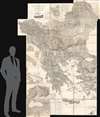
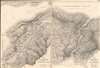
Coverage includes the European portion of the Ottoman Empire, including the present-day territories of Bulgaria, Greece, the Balkan republics, and portions of Romania and Turkey. Fantastic detail is evident throughout, including the meticulous documenting of settlements, waterways, wells, ports, mountains, administrative divisions, roads, fortifications and other military sites, soundings along coastlines, minerals and mines, post offices, and much else. Needless to say, such a detailed map in such a large format would be extremely useful in any military conflict.The title sheet at top-left includes a legend with an explanation of symbols and abbreviations used, as well as six scales: German or geographic miles, Turkish 'Reisestunden' (most likely the fersah فرسخ of about 3.5 miles or about ¾ of a German mile), Russian versts, English miles, French leagues, and Italian miles. Klafter (around six feet) are also used in some of the inset maps. The title sheet also has a vignette illustration showing Ottoman troops resting outside a settlement, with the Bosporus in the background.
The sheet to the immediate right of the title sheet includes a miniature schematic (squelette) of the entire map, with the proper location of each sheet, and a table with precise longitude (using the Ferro Meridian) and latitude coordinates of important cities and geographic points.
Eleven inset maps appear. They are, clockwise from bottom-right: Rhodes, Smyrna, Navarino Bay (Pylos), Asia Minor, the Bosporus Strait, the Dardanelles (Hellenspont), the Isthmus of Corinth, Lepanto (Nafpaktos), Prevesa (Preveza), Butrint (Butrinto), and Belgrade.
The statistical table at bottom lists the provinces of 'European Turkey' with their area (in German miles squared), their population (total and per square German mile), their most important cities with populations noted, and their administrative divisions.
One noteworthy feature is the use of French terminology, which may reflect the enduring influence of France, particularly in the realm of military science, in the decades after the Napoleonic Wars. For example, 'lieutenant' is used instead of 'leutnant', 'lieues' instead of 'ligen', and 'squelette' instead of 'skelett;' 'Carte' is used in the title itself but 'Karte' in the table just to the right of the title.
Austria and the 'Eastern Question'
Throughout the 19th century, the Ottoman empire was beset not only by external threats (a string of wars against Russia in particular) but also by internal division. National awakenings in the Balkans at the start of the 19th century forced Istanbul to relinquish control over Serbia and fight a losing battle to retain Greece. The 'Eastern Question,' that is, the reaction of European powers to a collapsing Ottoman Empire, was vexing. There was little appetite for large-scale conflict so soon after the Napoleonic Wars (1803 - 1815), yet rival imperial powers saw opportunities in the Ottoman.With the aim of preventing a larger conflict, Klemens von Metternich (1773 - 1859), the Austrian statesman and architect of the 'Concert of Europe,' advocated a strict neutrality through the Greek War of Independence (1821 - 1829) and the subsequent Russo-Turkish War of 1828 - 1829. He was also instinctively opposed to revolution, having witnessed the chaos of the French Revolution (1789 - 1799), and was dismayed that other powers were encouraging the Greeks without considering potential cascading repercussions. Austria followed events closely and, as this map's existence demonstrates, prepared for potential conflict, but avoided becoming directly involved. In the end, Austria's fear that Russia would completely occupy 'European Turkey' did not come to pass, mostly through British intervention, a signal of the shifting balance of power in Europe (Britain and Austria aligned in the following decades to check Russian expansion, with Britain playing the leading role). Metternich's concerns about revolution were perhaps vindicated, as the Greek War of Independence was only the first of a string of ethno-national autonomy movements that would eventually bring down not only the Ottomans but also the Hungarian, Austrian, and Russian Empires.
Publication History and Census
This map set was issued by the General Quartermaster Staff (Generalquartiermeisterstab) of the Austrian army and is attributed to Franz von Weiss. It had an enduring influence on the cartography of these regions, influencing later maps of 'European Turkey' through the 19th century. It was translated into English and published in several editions in the 1850s - 1870s by J. Petherham at the intervention of the soldier-geographer T. B. Jervis; these English translations were initially intended for use in the Crimean War.Jervis claimed that Weiss extensively employed Russian materials in crafting this map, which is entirely plausible given Russia's continuous military conflicts and tensions with the Ottomans in the preceding decades. Weiss had been dedicated to the task of mapping European Turkey since at least 1819, and had earlier produced an even rarer 1821-22 map titled Geographische Karte des Osmanischen Reiches in Europa nebst einem Theil von Anatolien in III Colonnen 18 Blätter. The present map also bears strong similarity to a contemporaneous fifteen sheet map by Pierre Lapie titled 'Carte Génerale de la Turquie d’Europe' (1822). The similarities between Weiss' and Lapie's maps result from both drawing on information from the same group of Austrian, French, and Russian nobles, diplomats, and military figures.
Fourteen institutions worldwide hold this map in their collections and it has no known history on the market.
Cartographer
Franz von Weiss (1791 - 1858), also written Franz von Weiß, was an Austrian military officer and cartographer. Little is known about his life and career, but he produced two influential, very large-scale maps of the European portion of the Ottoman empire along with several other maps for the Austrian military. More by this mapmaker...
Condition
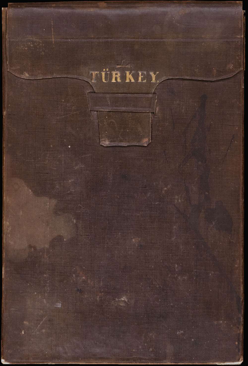
Good. Composed of twenty-one individual sheets segmented into quarters and backed on linen. Sheets fold into leather case. Foxing evident on some of the sheets.
References
Rumsey 12291. OCLC 256942137, 632842126, 1117728902, 494886461, 165483142. N. Ploutoglou et al, 'Franz von Weiss’ maps of SE Europe (1821, 1829) issued in two crucial dates associated with the establishment of the Modern Greek state in early 19th century: A digital comparative approach,' e-Perimetron, Vol. 6, No. 1, 2011, pp. 29-38.