1931 International At-A-Glance Chart Company Map of the United States
UnitedStates-ataglance-1931$350.00

Title
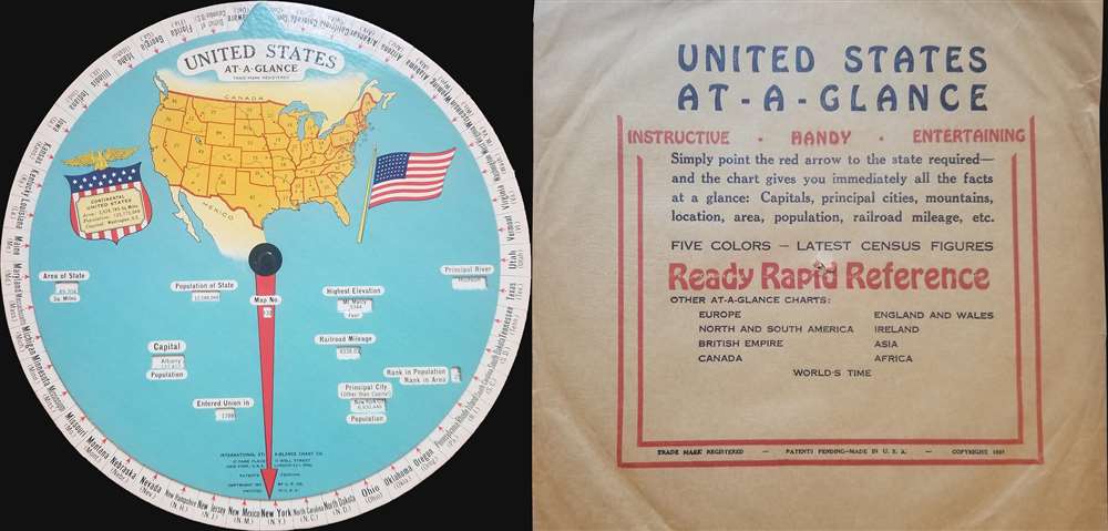
United States At-a-Glance.
1931 (dated) 10 x 10 in (25.4 x 25.4 cm) 1 : 42292800
1931 (dated) 10 x 10 in (25.4 x 25.4 cm) 1 : 42292800
Description
This is a 1931 International At-a-Glance Chart Company map of the United States. Created in the form of an interactive disk, the map depicts the entire continental United States from the Pacific Ocean to the Atlantic Ocean and from Canada to Mexico. Meant to be spun, the user rotates the inner disk bearing the illustration of the United States and points the red arrow at one of the states printed on the outer ring. Specific data for the desired state then appears in the windows cut into the inner disk, including the state's area, population, capital, highest elevation, principal city, rank in population and area, and the year the state entered the Union. The states are also numbered on the map, allowing the user to locate each state, as the corresponding map number is also provided for each state. The area and population of the continental United States are also given to the left of the map of the United States. It is also noted that the capital of the U.S. is Washington, D.C.
This wonderful piece of American history was created by the International At-a-Glance Chart Company and published in 1931.
This wonderful piece of American history was created by the International At-a-Glance Chart Company and published in 1931.
Condition
Very good. Accompanied by original envelope.