This item has been sold, but you can get on the Waitlist to be notified if another example becomes available, or purchase a digital scan.
1933 Mid-West Map Company Highway Map of the United States
UnitedStatesHighways-midwestmapco-1933$150.00


Title
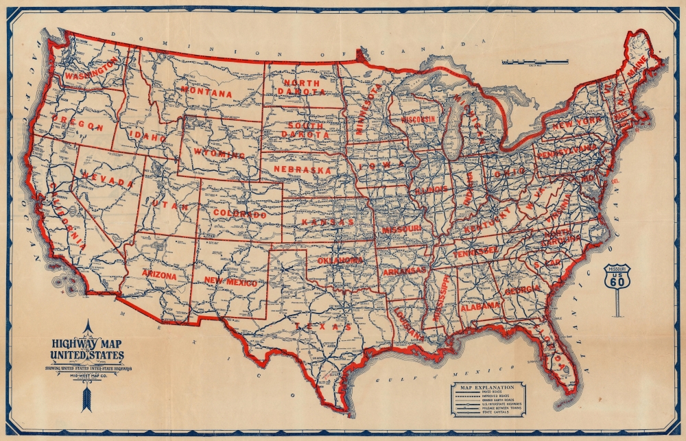
Highway Map of the United States Showing United States Inter-State Highways.
1933 (undated) 21 x 33 in (53.34 x 83.82 cm) 1 : 5848615
1933 (undated) 21 x 33 in (53.34 x 83.82 cm) 1 : 5848615
Description
This is a c. 1930 Mid-West Map Company highway map of the United States. The map marks the early days of the interstate highway system following the introduction of numbered highways just four years earlier in 1926.
A Closer Look
Embracing the full continental United States, this map highlings the growing American highway system. Shields mark U.S. highways, which vary from paved roads to 'graded earth roads'. Cities and towns are labeled with intervening mileage noted. National Parks, forests, and monuments, as well as state parks are highlighted.Historical Context - The American Automobile Craze
In the 1930s, the United States witnessed significant developments in its highway system, a period marked by the growth of automobile culture and the need for improved national road infrastructure. This era was greatly influenced by the advent of the U.S. Numbered Highway System in 1926, which introduced standardized numbering for cross-country routes, replacing the previous system of named auto trails. Iconic highways such as Route 66, which became a symbol of the American road trip, were established during this time. The 1930s also saw the influence of the New Deal under President Franklin D. Roosevelt, which implemented public works projects to combat the Great Depression. These projects included substantial investments in road construction and improvement, facilitating better connectivity, fostering economic growth, and accommodating the increasing number of automobiles.Publication History and Census
This map was created and published by the Mid-West Map Company c. 1930. The Mid-West Map Company published at least two subsequent editions, in which they updated the font, moved the scale and key, and added population statistics. This is the only known example of this edition.Cartographer
Mid-West Map Company (c. 1925 - 1935) was an Aurora, Missouri-based company that issued early highway maps to travelers for free, covering their costs and earning a profit through sponsorship and advertisements for gas stations, motels, and other businesses along highway routes. Little is known about the company's history and its maps were undated, making an exact date range of its existence difficult to establish, but the company's efforts resulted in the first comprehensive set of highway maps for the entire country. Its model of providing free highway maps to travelers would become a standard practice for decades, especially by competing gas station chains. More by this mapmaker...
Condition
Good. Wear along original fold lines. Verso repairs to fold separations. Closed margin tears professionally repaired on verso. Light creasing. Small areas of infill at three fold intersections.