This item has been sold, but you can get on the Waitlist to be notified if another example becomes available, or purchase a digital scan.
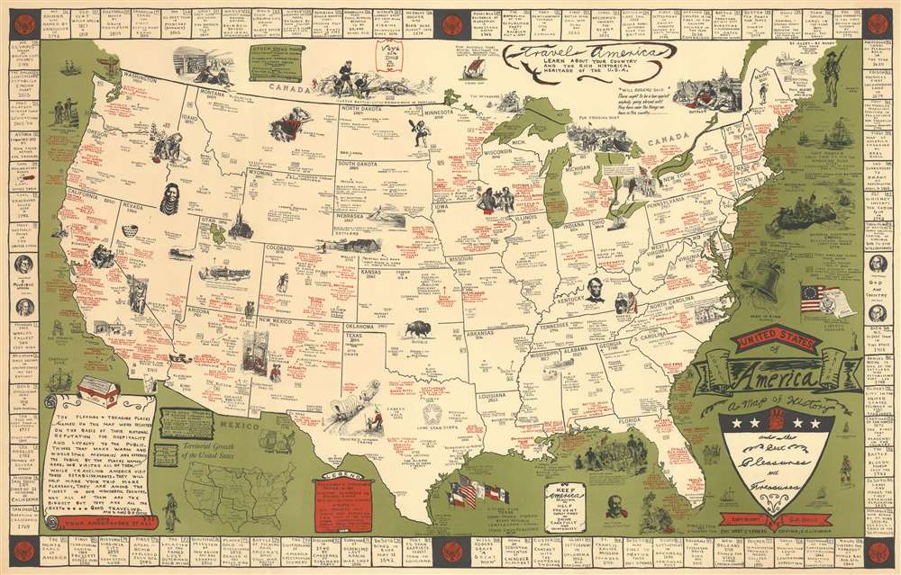
1953 Garner Parker Dicus Pictorial Map of the United States
UnitedStatesHistory-dicus-1953$500.00

Title
United States of America. A map of History and the Best Pleasures and Treasures.
1953 (undated) 16.5 x 26.125 in (41.91 x 66.3575 cm) 1 : 8500000
1953 (undated) 16.5 x 26.125 in (41.91 x 66.3575 cm) 1 : 8500000
Description
This is a rare c. 1953 Garner Parker Dicus pictorial map of the continental United States. Created to encourage tourism, red text marks resorts, hotels, restaurants, and other modern attractions. Black text marks major cities, provides historical information, and identifies other important locations, such as national parks. Many locations are marked with small red circles, indicating Dicus and his wife's personal recommendation. Per a text in the lower left, Mr. and Mrs. Dicus claim to have visited every location labeled in red. Pictorial vignettes scattered throughout the map add charm to the piece and focus on American history. Stagecoaches, covered wagons, gold miners, explorers, and fur trappers are among these vignettes, alongside a portrait of Abraham Lincoln and George Washington crossing the Delaware River. References to eighty-one historical events create the map's border. Corresponding numbers appear across the map, allowing viewers to place each event.
Publication History and Census
This map was created and published by Garner Parker Dicus in 1953. We note an example in the David Rumsey Map Collection and an example cataloged in OCLC, part of the collection at the University of Utah.Cartographer
Garner Parker Dicus (January 10, 1921 - December 21, 1999) was born in Pocahontas, Iowa. He served in the U.S. Navy during World War II and made a handful of pictorial maps of the United States in the 1950s. He married Bernice Rosetta Cook (May 1, 1908 - February 18, 2003) in 1945 and the couple divorced in 1966 or 1967. He died in Fontana, California on December 21, 1999. More by this mapmaker...
Condition
Very good. Closed margin tear professionally repaired on verso.
References
Rumsey 12009.000. OCLC 22296913.

