This item has been sold, but you can get on the Waitlist to be notified if another example becomes available, or purchase a digital scan.
1876 Walker Railroad Map of the United States
UnitedStatesRailroad-walker-1876$87.50

Title
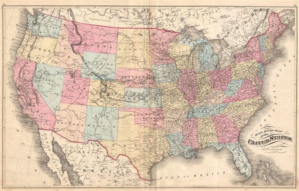
Railroad Map of the United States.
1876 (undated) 27.25 x 16.75 in (69.215 x 42.545 cm)
1876 (undated) 27.25 x 16.75 in (69.215 x 42.545 cm)
Description
Beautifully detailed Railroad Map of the United States, with the Rocky Mountains depicted by fine hachure as a single thin line of mountains. Fascinating to see the country at the precise moment of its centennial. Drawn by H.H. Lloyd & Co. N.Y., published as plates 14 & 15 on facing pages in Walker & Pease' exquisite 'topographical, illustrated, historical, descriptive' Atlas of Bergen County, New Jersey, 1876. With a beautiful map of North America on verso (plate 13).
Source
Walker, A. H., and Pease, C. C., Atlas of Bergen County, New Jersey, 1876.
Condition
Good. Even overall toning. Original centerfold exhibits some wear and in verso reinforcement. Minor discolorations here and there. Edge wear mostly confined to margins.
References
Phillips (Atlases) #2152.