This item has been sold, but you can get on the Waitlist to be notified if another example becomes available.
1955 Billingsley Pictorial Map of Vashon-Maury Island, Washington
VashonMaury-billingsley-1955$100.00

Title
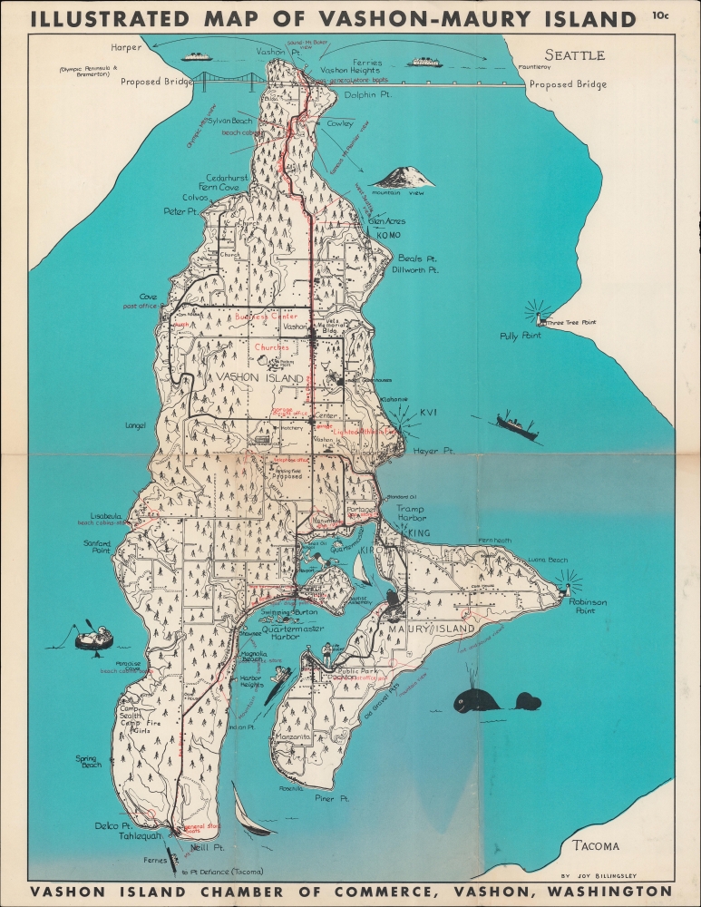
Illustrated Map of Vashon-Maury Island.
1955 (undated) 21.5 x 15.75 in (54.61 x 40.005 cm) 1 : 45000
1955 (undated) 21.5 x 15.75 in (54.61 x 40.005 cm) 1 : 45000
Description
A whimsical c. 1955 pictorial map of Vashon and Maury Islands in Puget Sound, southwest of Seattle, Washington, drawn by local resident Joy Billingsley.
A Closer Look
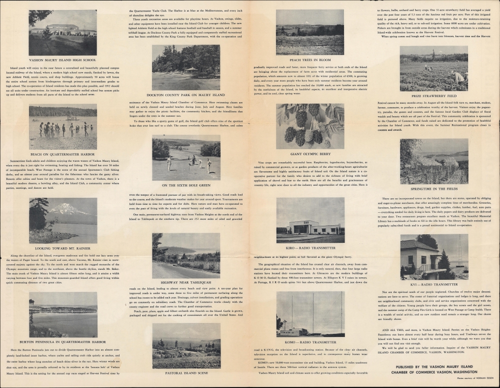
Covering Vashon and Maury Islands (actually one island connected by a narrow isthmus) and their vicinity, the map marks churches, lighthouses, stores, camps, parks, radio towers, schools, scenic vistas, beaches, a golf course, and other locations. Many of these sites appear in photographs on the verso, along with pictures of local agricultural produce. Boats, trees, animals, and human figures are illustrated throughout. Black squares appear to mark out every structure on the islands in the style of U.S. Coast Survey charts.Proposed Bridge
The proposed bridge seen at top has long been considered but never built, as groups of residents on Vashon Island have resisted it to preserve the mostly rural character of the island (an easy connection to Seattle would almost certainly result in the islands' rapid suburbanization). Therefore, travel to and from Vashon-Maury is typically accomplished by ferry. An airport (the Vashon Municipal Airport) was later built, further north of the site seen here, on land purchased from a locally prominent Japanese-American family of strawberry growers.Publication History and Census
This pictorial map was drawn by Harriet Joy Billingsley and published by the Vashon Maury Island Chamber of Commerce around 1955. A dated 1958 edition, revised from the present map by D. J. Sweeny, was later published with a different set of photographs on the verso. The University of Washington also holds a c. 1960 example issued by the Vashon Commercial Club rather than the Chamber of Commerce (OCLC 1401837985). Any of these editions are quite rare in institutional collections, with the present edition only being held by the Washington State Library.Cartographer
Harriet Joy Billingsley (1915 - ?) was an illustrator and resident of Vashon, Washington, a picturesque island in Puget Sound. Her only known published work was a pictorial map of Vashon and Maury Islands, produced in several editions in the 1950s. She was born in Butte, Montana, but her family appears to have relocated to the Seattle area during her childhood. Her father was a geologist, which may have sparked her interest in geography and maps. More by this mapmaker...
Condition
Good. Light wear along original folds. Slight loss at junctions of folds. Slight discoloration.
References
OCLC 276305425.