This item has been sold, but you can get on the Waitlist to be notified if another example becomes available, or purchase a digital scan.
1927 Nostrand Birds-Eye View Map of New York City, New York
ViewofNewYork-nostrand-1927$375.00

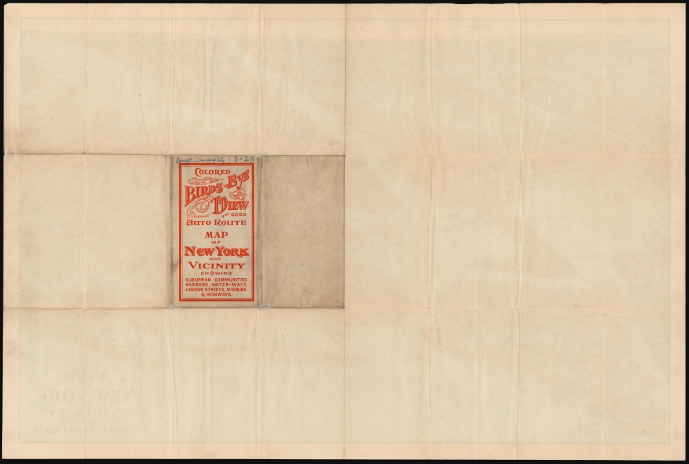


Title
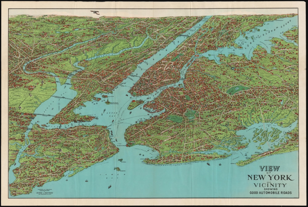
View of New York and Vicinity Showing Good Automobile Roads.
1927 (undated) 21 x 30 in (53.34 x 76.2 cm)
1927 (undated) 21 x 30 in (53.34 x 76.2 cm)
Description
This is an engaging 1927 birds-eye view map of New York City and vicinity by George J. Nostrand. Brightly colored and evocative, the view presents New York City and its surrounds at the height of 'the Roaring Twenties.' As the title suggests, it was meant to highlight the most auto-friendly of New York City’s roads during an era in which the automobile was still a relative novelty and the outer boroughs were not yet fully developed.
A Closer Look
All five New York City Boroughs are represented, and the map encompasses Westchester County, Bergen County, and Nassau County in Long Island. Ferry routes appear prominently, and the East River is spanned by the Brooklyn, Manhattan, Williamsburg, and Queensboro Bridges. In addition to major roads, the map details specific neighborhoods, with the character of their development and topography beautifully rendered. Individual landmarks, buildings, and bridges are illustrated throughout, including the Statue of Liberty, Ellis Island, Grand Central, Madison Square Garden, Museum of Natural History, and Metropolitan Museum of Art. The harbor is full of ships while an airplane - in fact, Charles Lindbergh's Spirit of St. Louis - soars over Paterson.When in the Twenties?
Although the view is not dated, there is a handwritten notation on the cover, printed on the verso: 'Bought in New York City 1-8-28.' The likelihood of its having been printed in the first eight days of 1928 is slim! The content of the map narrows the window of its possible production considerably: The Spirit of St. Louis did not have its first flight until April of 1927, and the Holland Tunnel was completed and named that year. It is named on this map. The George Washington Bridge appears as 'proposed;' it was constructed between September 1927 and 1931 and would not be named until completion. (We are aware of a further state of the map with this 'proposed' notation removed, but still with no name for the bridge.) The Goethals Bridge, also unnamed and marked 'proposed', was constructed between 1925 and 1928. We had, conservatively, pinned the production of this map at 1928 but the date notation mentioned above leads us to conclude that map had to be produced in the autumn or early winter of 1927. These were intended for sale atop the Woolworth's Building - then still the tallest building in the world.Linoleumville
On Staten Island at the location of present-day Travis-Chelsea, is marked the town of 'Linoleumville' - so named for being the site of America's first linoleum factory. At the beginning of the 20th century, Linoleumville was home to some 700 immigrants - English and Polish, predominantly - who had arrived to work in the American Linoleum Company factory. The linoleum workers comprised half of the local population. When the factory closed in 1930, the embittered town residents chose to change the name of the neighborhood back to Travis. The change did not go unnoticed. Many national newspapers ran an op-ed decrying the removal of colorful place names from American towns. The December 29, 1930, Olean Times ran the waspish comment, 'No doubt those residents of Linoleumville who were responsible for changing the name of the town to Travis felt they had been walked on long enough.'Publication History and Census
The map appears to be based on an earlier 1902 map by August R. Ohman, whose office was in the same building as Nostrand until 1925. This view was copyrighted, lithographed, and published by George J. Nostrand, whose shop was a few blocks north of the Woolworth Building, from whose observation deck this map was sold. OCLC shows two examples of the present state, with an assigned date of 1928. and three of a further 1929 state in institutional collections. This present example is of the 1927 issue.Cartographer
George J. Nostrand (fl. 1920-30) was an American lithographer and publisher of maps and views, primarily of New York City. He appears to have been in the employ of the Arthur Ohman Map Co. until the firm’s closing in 1925. Thereafter he operated from the same location under his own name as late as 1939. More by this mapmaker...
Condition
Good. Some wear with very slight loss at junctures of folds, else very good.
References
Rumsey 11270.000 (1928 state). OCLC 429466410.