
This item below is out of stock, but another example (left) is available. To view the available item, click "Details."
Details
1954 Hétreau Pictorial Wine Map of the Champagne Wine Region, France
1954 (dated) $650.00
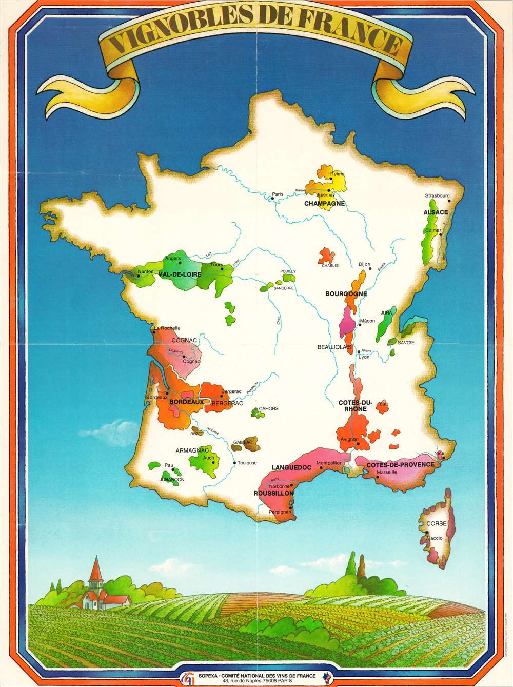
1970 Sopexa Map of France Wine Regions
VignoblesdeFrance-sopexa-1970$175.00

Title
Vignobles de France.
1970 (undated) 21 x 15.5 in (53.34 x 39.37 cm) 1 : 3000000
1970 (undated) 21 x 15.5 in (53.34 x 39.37 cm) 1 : 3000000
Description
This is a c. 1970 SOPEXA and Comité national des vins de France map of France and its wine regions. Over a dozen prominent French wine regions are highlighted using different colors, including Champagne, Bordeaux, Côtes-du-Rhone, Val-de-Loire, Côtes-de-Provence, Bourgogne, and Beaujolais. Smaller regions, including Chablis, Jura, and Savoie are labeled as well. Aditionally, the areas where Cognac and Armagnac are distilled appear as well. France's rivers are illustrated and its major cities, such as Paris, Lyon, Bordeaux, Nice, Marseille, and Avignon. A charming illustration of a French vineyard decorates the bottom border.
Publication History and Census
This map was created by Edery and was jointly published by SOPEXA and the Comité national des vins de France. Several editions were published during the 1970s and 1980s. One example from the 1970s is cataloged in OCLC and is part of the institutional collection at ETH-Bibliothek Zurich in Zurich, Switzerland.Condition
Very good. Truncated top border. Blank on verso.
References
OCLC 637853005.