This item has been sold, but you can get on the Waitlist to be notified if another example becomes available.
1964 Tourist City Plan or Map of Greenwich Village, New York City
VillageHiSpots-ceresearch-1964$325.00

Title
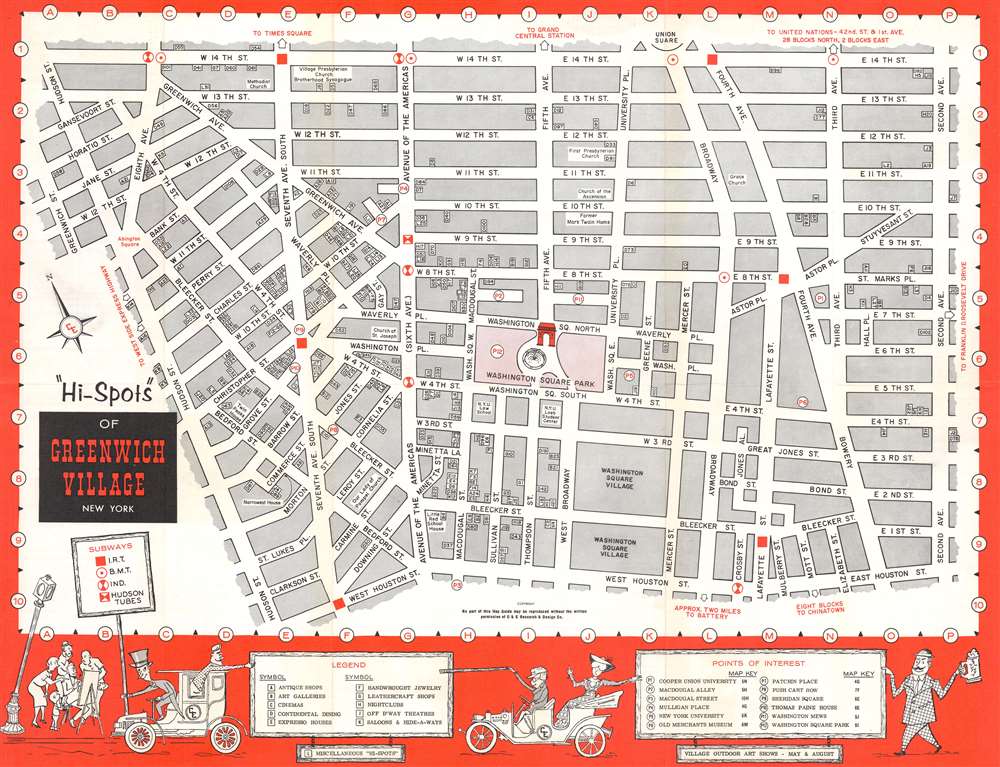
'Hi-Spots' of Greenwich Village New York.
1964 (undated) 16.75 x 22 in (42.545 x 55.88 cm) 1 : 3800
1964 (undated) 16.75 x 22 in (42.545 x 55.88 cm) 1 : 3800
Description
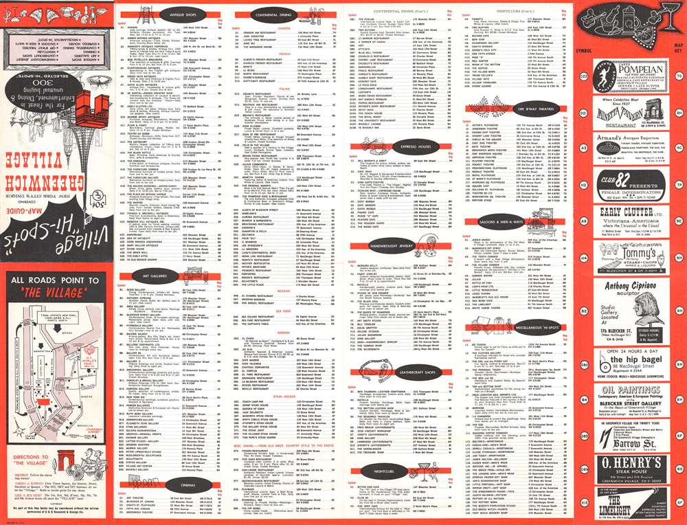
This is a c. 1964 'C and E Research and Design' tourist city plan or map of Greenwich Village, New York City. Depicting from 14th Street south to Houston Street and from Hudson Street east to Second Avenue, 'hi-spots' and other points of interest are identified throughout. Washington Square Park and its Arch are in red at center. Numerous houses of worship, including churches and a synagogue, are labeled on the map, along with NYU's Loeb Student Center and the NYU Law School. Alphanumeric symbols label each location and correspond with an index printed on the verso. These locations are divided into categories including antiques (A), art galleries (B), cinemas (C), Continental Dining (D), Expresso Houses (E), nightclubs (H), Off-Broadway Theaters (J), and saloons (K). I.R.T., B.M.T., and Ind. subway stations are marked as well. Aside from the index, advertisements for local businesses and a small map illustrating how to get to Greenwich Village also appear on the verso. This small map allows us to date this piece to c. 1964, because it marks the site of the 1964 - 1965 New York World's Fair.
Publication History and Census
This map was created and published by C and E Research and Design c. 1964. We are aware of only one other example in private hands. This piece is not cataloged in OCLC.Condition
Very good. Exhibits light wear along original fold lines. Index on verso.