This item has been sold, but you can get on the Waitlist to be notified if another example becomes available, or purchase a digital scan.
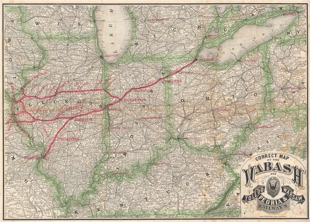
1878 Rand McNally Railroad Map of Illinois, Indiana, and Ohio
WabashToledo-randmcnally-1878$325.00

Title
Correct Map of the Wabash and Toledo, Peoria, and Warsaw Railways.
1878 (dated) 15.5 x 21.75 in (39.37 x 55.245 cm) 1 : 2000000
1878 (dated) 15.5 x 21.75 in (39.37 x 55.245 cm) 1 : 2000000
Description
This is an 1878 Rand McNally map of Illinois, Indiana, and Ohio illustrating the Wabash Railway and the Toledo, Peoria, and Warsaw Railway. Red overprinting highlights the routes and block lettering marks major stops, including St. Louis, Hannibal, Quincy, Springfield, Lafayette, Fort Wayne, and Toledo. Other major cities, such as Cleveland, Detroit, Cincinnati, Chicago, Louisville, and Cairo, are marked. Competing and connecting railroads are traced as well.
The Wabash Railway
The Wabash Railway formed on January 10, 1877 through a three-way merger of the Wabash Railway Company of Illinois, the Wabash Railway Company of Indiana, and the Wabash Railway Company of Ohio. Despite being extremely profitable (it earned over $1 million in 1877 and exceeded $1.5 million in 1878), the railway lasted for less than two years. In 1879 it merged with the St. Louis, Kansas City and Northern Railway Company to create the Wabash, St. Louis, and Pacific Railway Company. (Grant, H. Roger. 'Follow the Flag': A History of the Wabash Railroad Company (Dekalb, Illinois: Northern Illinois University Press) 2004.)The Toledo, Peoria, and Warsaw Railway
The Toledo, Peoria, and Warsaw Railway came into existence on May 14, 1864, after financial difficulty forced the Logansport, Peoria, and Burlington Railroad to change its name. The TPW operated under that name until, suffering financially, went into receivership on January 20, 1875. on December 16, 1879, the receivership reorganized the railroad as the Toledo, Peoria, and Western Railroad. It merged with the Toledo, Peoria, and Warsaw on May 22, 1880.Publication History and Census
This map was created by Rand McNally and published in 1878. This is the only known surviving example.Cartographer
Rand, McNally and Co. (fl. 1856 - present) is an American publisher of maps, atlases and globes. The company was founded in 1856 when William H. Rand, a native of Quincy, Massachusetts, opened a print shop in Chicago. Rand hired the recent Irish immigrant Andrew McNally to assist in the shop giving him a wage of 9 USD per week. The duo landed several important contracts, including the Tribune's (later renamed the Chicago Tribune) printing operation. In 1872, Rand McNally produced its first map, a railroad guide, using a new cost effective printing technique known as wax process engraving. As Chicago developed as a railway hub, the Rand firm, now incorporated as Rand McNally, began producing a wide array of railroad maps and guides. Over time, the firm expanded into atlases, globes, educational material, and general literature. By embracing the wax engraving process, Rand McNally was able to dominate the map and atlas market, pushing more traditional American lithographic publishers like Colton, Johnson, and Mitchell out of business. Eventually Rand McNally opened an annex office in New York City headed by Caleb S. Hammond, whose name is today synonymous with maps and atlases, and who later started his own map company, C. S. Hammond & Co. Both firms remain in business. More by this mapmaker...
Condition
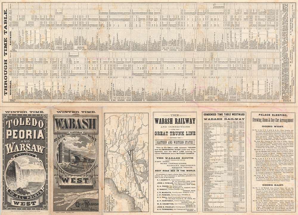
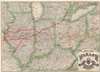
Good. Exhibits wear along original fold lines. Exhibits verso repairs at two fold intersections. Soiling. Time table, advertising, and small map printed on verso.