1959 U.S. Air Force Aeronautical Map of Northern Sumatra, Indonesia
WeIsland-usaf-1959$100.00

Title
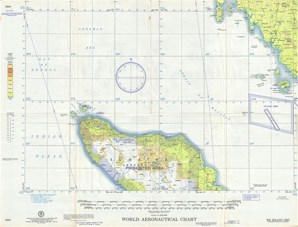
We Island Indonesia-Malay-Thailand.
1959 (dated) 22 x 29 in (55.88 x 73.66 cm) 1 : 1000000
1959 (dated) 22 x 29 in (55.88 x 73.66 cm) 1 : 1000000
Description
This is a fine 1959 U.S. Air Force aeronautical chart or map of northern Sumatra and Weh Island (We Island) or Sabang. Focusing on Weh (We) Island or Sabang, it covers the region from Phuket, Thailand south to Pangkalan Brandan in Sumatra, Indonesia. The chart notes caution areas, cities, rivers, lakes, roads, islands, reefs, topography and other data essential for the air pilot. Verso features legends and a world aeronautical chart index. This chart was published by the Aeronautical Chart and Information Center and issued as chart no. 800. First issued in 1953, this is the ninth edition revised to Jan. 1959.
Condition
Very good. Minor wear and toning along original fold lines. Minor spotting.