This copy is copyright protected.
Copyright © 2024 Geographicus Rare Antique Maps
1903 Scarborough Company Map of Western United States w/Philippine Islands
WesternUnitedStates-scarborough-1903-2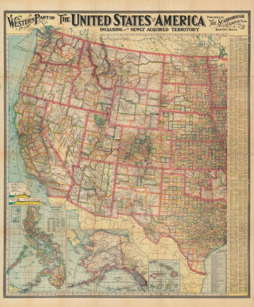


Scarborough Company (1885 - 1913) was founded by the brothers Walter C. Scarborough (June 4, 1862 - May 9, 1904) and Howard G. Scarborough (December 23, 1867 - June 10, 1905). Walter, the older brother, was born in Providence, Rhode Island, and studied at the Boston University Law School. The Scarborough brothers founded their map publishing concern in 1885. Initially, there were three separate firms: the National Publishing Company (Portland, Maine, 1897), later based in Boston; the Dominion Publishing Company, based in Canada; and the Scarborough Publishing Company, based in London. These three firms each published semi-independently but were merged with a capital of 1,000,000 USD in 1902, subsequently publishing under the Scarborough imprint. Howard took over full management of the Scarborough in 1904 when Walter died. Howard was also in poor health, suffering from tuberculous, and relocated to Europe in 1900, where he lived in a sanatorium. He returned to the United States in 1902, settling first in Asheville, North Carolina, then at a sanatorium community in Oracle, Arizona. Until his death, he managed the Scarborough Company remotely. From about 1904, there was another branch of the firm located at 227 East Ohio Street in Indianapolis, Indiana. After Howard's 1905 death, the management of the firm, as well as its principal manufacturing and distribution points, was relocated to Indianapolis. In 1913, it became the Scarborough Motor Guide Company (c. 1913 - c. 1933). More by this mapmaker...
Copyright © 2024 Geographicus Rare Antique Maps | Geographicus Rare Antique Maps
This copy is copyright protected.
Copyright © 2024 Geographicus Rare Antique Maps