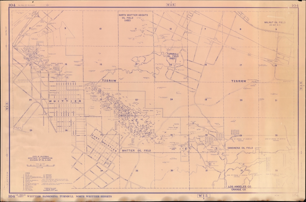
1988 California Division of Oil and Gas Map of Whittier, California and Environs
WhittierOil-caloilgas-1988$350.00

Title
104 Los Angeles County Whittier Sansinena Turnbull North Whittier Heights.
1988 (dated) 30 x 45.25 in (76.2 x 114.935 cm) 1 : 12000
1988 (dated) 30 x 45.25 in (76.2 x 114.935 cm) 1 : 12000
Description
A scarce, large-format 1988 oil and gas map of Whittier and surrounding communities in southeastern Los Angeles County, produced by the California Department of Conservation's Division of Oil and Gas.
The hills which constitute much of the upper portion of this map offer some of the most scenic views in Southern California. The area is home to hiking trails, the Fo Guang Shan Hsi Lai Temple (one of the largest Buddhist temples in the Western Hemisphere), and the Rose Hill Cemetery at top-left, now expanded and renamed the Rose Hills Memorial Park, the largest cemetery in North America.
A Closer Look
This map covers a portion of southeastern Los Angeles County, including the cities and towns of Whittier, La Habra Heights, and Hacienda Heights. Oil fields, roads (including the San Gabriel and Pomona Freeways, I-605 and CA SR 60, respectively), railways, and other features are labelled, while a survey line grid overlays the map, dividing it into 36 squares. Dozens of oil and gas wells, including abandoned and plugged ones, as well as related oil and gas infrastructure, are labelled according to the legend at bottom-left. Many wells have their parent company labelled, including familiar names such as Chevron and the utility Southern California Gas, as well as smaller operators. A handwritten note at left explains that 'Temple wells didn't get oil,' suggesting that this map saw 'field use.'Come for the Oil, Stay for the View
This area has a long history with oil and gas production, with these fields being among the earliest reserves to be tapped in the Southern California oil boom of the late 19th century (the Brea-Olinda Oil Field just to the east was discovered in 1880, and the Whittier Oil Field near center here in 1897). In the early 20th century, the area primarily produced crude oil, which was then transported to refineries for processing. The booming oil industry helped to lay a basis for the development of Whittier and surrounding communities. In the mid-late 20th century, production declined as easily accessible oil reserves were depleted, increasing costs. Environmental concerns also played a role, and much of the land once dedicated to extraction of oil and gas has now been converted to parkland, though as this map indicates the area remained home to many active wells into the late 20th century.The hills which constitute much of the upper portion of this map offer some of the most scenic views in Southern California. The area is home to hiking trails, the Fo Guang Shan Hsi Lai Temple (one of the largest Buddhist temples in the Western Hemisphere), and the Rose Hill Cemetery at top-left, now expanded and renamed the Rose Hills Memorial Park, the largest cemetery in North America.
Publication History and Census
This map was produced by the California Department of Conservation's Division of Oil and Gas in April 1988. It appears to be part of a series of maps covering oil and gas fields in Los Angeles County. We have been unable to locate any other examples of this map in institutional collections or on the market.Condition
Good. Slight edge wear and loss. Closed margin tear professionally repaired on verso. Some soiling.


