1939 United Press Broadside Map of the World and Pictorial History
WorldNews-unitedpress-1939$425.00


Title
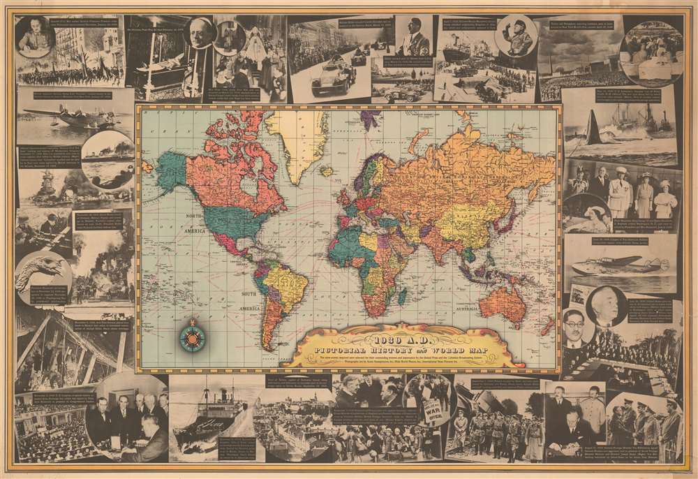
1939 A. D. Pictorial History and World Map.
1939 (dated) 21 x 30.5 in (53.34 x 77.47 cm) 1 : 84480000
1939 (dated) 21 x 30.5 in (53.34 x 77.47 cm) 1 : 84480000
Description
This 1939 United Press and Columbia Broadcasting System map of the world ravaged by war. The political map at center belies the violence then rampaging across the globe, but its results are apparent. Nazi Germany encompasses Austria and half of Czechoslovakia and Poland, while the Soviet Unit occupies Poland's other half. War had been raging in Asia since 1937, mostly ignored here, apart from Manchukuo. Dashed lines trace global maritime trade routes and provide the distances.
The Pictorial Border
The border consists of printed photographs illustrating the European war, including the signing of the Nazi-Soviet Nonaggression Pact, Nazi Germany's invasions of Poland and Czechoslovakia, and German ships set ablaze. Other images celebrate technological advances, such as the inaugural Pan-American trans-Atlantic clipper service and the 1939 New York World's Fair. Pope Pius XI's death is remembered, as is the crowning of Pius XII.Publication History and Census
This map was created and published by the United Press and Columbia Broadcasting System in 1939. One example is cataloged in OCLC as being part of the collection at the Osher Map Library at the University of Southern Maine.Condition
Good. Laid down on archival tissue. Lower right corner reinstated.
References
Rumsey 8136.000. OCLC 55796954.