1968 Pan American World Airways Route Map of the World
WorldRoutes-panamerican-1968$975.00


Title
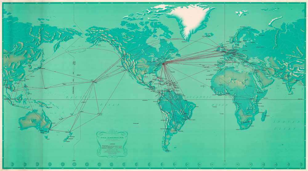
Pan American Airways System. World's Most Experienced Airline.
1968 (dated) 33 x 59 in (83.82 x 149.86 cm) 1 : 26400000
1968 (dated) 33 x 59 in (83.82 x 149.86 cm) 1 : 26400000
Description
Published at the height of Pan American's success, this is a 1968 Pan American Airways (Pan Am) route map of the world. At the time, Pan American operated flights to eighty-six countries on six continents. Red lines highlight Pan American's routes across the globe, with numbers providing each route's distance in miles and kilometers. Pan Am's impressive network connected its hub at John F. Kennedy Airport in New York City with the rest of the world. The airline serviced islands throughout the Caribbean, South America, western and central Europe, the Middle East and East Asia, and several Pacific islands.
Publication History and Census
This cartography for this map was created by John Philip and the art was created by Paul John Brown. This map was originally published in 1956, with the present edition bearing corrections up to January 1, 1968. We note five examples of the original 1956 edition cataloged in OCLC, but we have been unable to locate any cataloged examples of the present 1968 edition. Examples of the 1956 and 1964 editions are part of the David Rumsey Map Collection.Condition
Very good. Closed tear extending one-and-one-half (1.5) inches from top edge professionally repaired on verso. Closed margin tears professionally repaired on verso.
References
OCLC 648933109.