1895 Rand McNally Wyoming Pocket Map
Wyoming-randmcnally-1895$400.00

Title
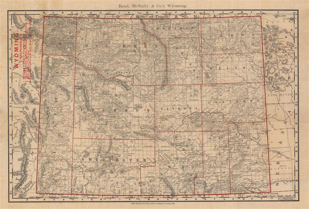
Rand, McNally and Co.'s Wyoming.
1895 (dated) 12.5 x 19 in (31.75 x 48.26 cm) 1 : 1530000
1895 (dated) 12.5 x 19 in (31.75 x 48.26 cm) 1 : 1530000
Description
This is a scarce 1895 separate-issue pocket map of Wyoming published by Rand McNally. It depicts the entire state, only elevated from a territory five years prior, with a range of administrative, geographic, and infrastructural information. The map may be derived from Rand McNally's atlas map of the same year, but exhibits red overprinting for titling and other important data.
Black lines indicate railroads, which are tagged to a list at top-left. Elevation is illustrated by hachure, with mountains and hills labeled. Rivers, creeks, and lakes are also noted. The subcounty level grids created by the intersections of 'standard parallel north' lines and auxiliary or guide meridians relate to land surveys conducted in the American territories in the preceding decades.
Yellowstone National Park is included in full at top-left. To its immediate right is the Yellowstone Park Timber Land Reservation, the first national forest in the U.S., created by the General Revision Act (also known as the Forest Reserve Act) of 1891. Further south, still in western Wyoming, is the Shoshone or Wind River Indian Reservation, among the larger Indian Reservations in the U.S., both in terms of population and land. It is home to both Eastern Shoshone and Northern Arapaho peoples, who were pushed together when the Arapaho were chased out of their ancestral homeland in the Pike’s Peak Gold Rush and the Colorado War (1864 - 1865). The U.S. Army resettled them at Ft. Washakie until a permanent reservation location could be agreed upon, but such an agreement never came, causing a quarrel with the Shoshone who had already been guaranteed the surrounding territory. The land dispute was only settled by the U.S. Supreme Court decades later and remains a sore spot between the two tribes despite gradually improving relations in the decades since.
Wyoming was still a sparsely-populated frontier at the time this map was published. Nevertheless, the suitability of the land for grazing livestock could lead to disputes, as with the Johnson County War of 1892. Other forms of frontier violence also occurred, most notoriously the Rock Springs Massacre of 1885 that targeted Chinese miners.
A Closer Look
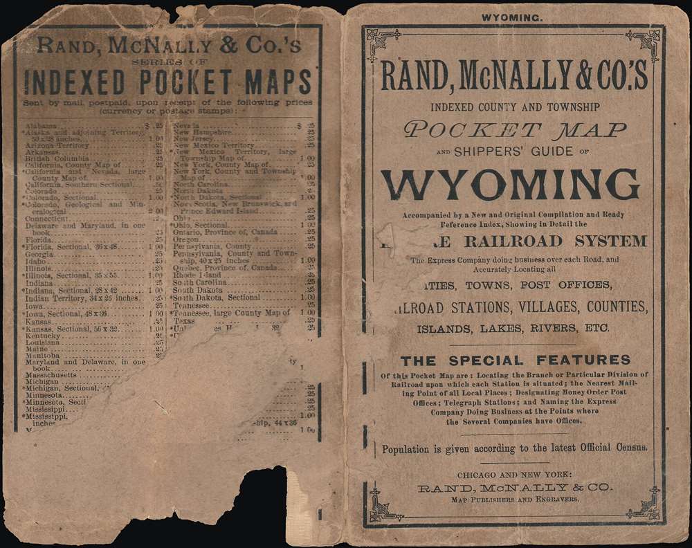
The map is bordered by a grid of letters and numbers in the margins for location of features in a corresponding index. It is rather unusual in that Rand McNally indexed pocket maps from this era generally include the index on the recto (front), continued on the verso if necessary. In this case, it appears that the index was included on a separate sheet that has been lost.Black lines indicate railroads, which are tagged to a list at top-left. Elevation is illustrated by hachure, with mountains and hills labeled. Rivers, creeks, and lakes are also noted. The subcounty level grids created by the intersections of 'standard parallel north' lines and auxiliary or guide meridians relate to land surveys conducted in the American territories in the preceding decades.
Yellowstone National Park is included in full at top-left. To its immediate right is the Yellowstone Park Timber Land Reservation, the first national forest in the U.S., created by the General Revision Act (also known as the Forest Reserve Act) of 1891. Further south, still in western Wyoming, is the Shoshone or Wind River Indian Reservation, among the larger Indian Reservations in the U.S., both in terms of population and land. It is home to both Eastern Shoshone and Northern Arapaho peoples, who were pushed together when the Arapaho were chased out of their ancestral homeland in the Pike’s Peak Gold Rush and the Colorado War (1864 - 1865). The U.S. Army resettled them at Ft. Washakie until a permanent reservation location could be agreed upon, but such an agreement never came, causing a quarrel with the Shoshone who had already been guaranteed the surrounding territory. The land dispute was only settled by the U.S. Supreme Court decades later and remains a sore spot between the two tribes despite gradually improving relations in the decades since.
Wyoming was still a sparsely-populated frontier at the time this map was published. Nevertheless, the suitability of the land for grazing livestock could lead to disputes, as with the Johnson County War of 1892. Other forms of frontier violence also occurred, most notoriously the Rock Springs Massacre of 1885 that targeted Chinese miners.
Publication History and Census
This map was published by Rand McNally in 1895, based on the 1891 map of Wyoming in their Indexed Atlas of the World. As a separate issue pocket map, it is very rare, only being listed among the collections of the Newberry Library and with no known history on the market.Cartographer
Rand, McNally and Co. (fl. 1856 - present) is an American publisher of maps, atlases and globes. The company was founded in 1856 when William H. Rand, a native of Quincy, Massachusetts, opened a print shop in Chicago. Rand hired the recent Irish immigrant Andrew McNally to assist in the shop giving him a wage of 9 USD per week. The duo landed several important contracts, including the Tribune's (later renamed the Chicago Tribune) printing operation. In 1872, Rand McNally produced its first map, a railroad guide, using a new cost effective printing technique known as wax process engraving. As Chicago developed as a railway hub, the Rand firm, now incorporated as Rand McNally, began producing a wide array of railroad maps and guides. Over time, the firm expanded into atlases, globes, educational material, and general literature. By embracing the wax engraving process, Rand McNally was able to dominate the map and atlas market, pushing more traditional American lithographic publishers like Colton, Johnson, and Mitchell out of business. Eventually Rand McNally opened an annex office in New York City headed by Caleb S. Hammond, whose name is today synonymous with maps and atlases, and who later started his own map company, C. S. Hammond & Co. Both firms remain in business. More by this mapmaker...
Condition
Good. Fold lines visible with wear at fold intersections. Dampstaining in left margin along edge. Sporadic spots of discoloration.
References
OCLC 1001313488.