
Allard, Carel

Carel Allard (1648 - 1709) was a Dutch art dealer, cartographer and engraver. In the 17th century, the Allard family published various maps in Amsterdam. Carel was the son of mapmaker and engraver Hugo Allard. He appears to have been somewhat prolific and successful than his father: he produced in his lifetime a 1697 Atlas Minor, the c. 1705 Atlas Major and several other works with engraved plates, as well as continuing to publish from his father's stock. He passed along his copperplates to his son Abraham (1676-1725) prior to going bankrupt in 1706.
Bold, detailed rarity of Spain and Portugal.
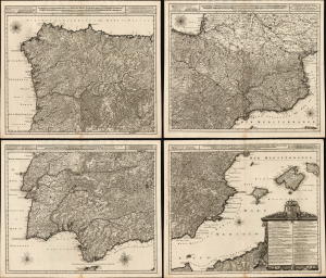
Novissima, et Accuratissima Tabula, qua Gallaeciae et Legionis Regna, Asturiarum Principatus. Portugalliae Tractus Septentrionalis et Utriusque Castellae, Extremadurae et Biscajae Partes./ ... Regnorum Arragoniae et Navarre, Principatus Cataloniae, nec non Partium con Conterminarum, Biscajae Utriusque Castellae ac Valentiae./ ... Regnorum Vandalitiae, Granatae, et Algarbiae; Tractuum, Meridionalium Portugalliae Extremadurae ac Castellae Novae./... Regnorum Valentiae et Murciae, Insularum Majorcae, Minorcae, et Ivicae qua etiam Vicinorum Regnorum Finitime Partes.
$8,500.00
Acquire
- Digital Map Information
- Suitable for large format printing
- Full resolution TIFF file
- ICC color profile embedded
- Delivered instantly via download link
This is a superb, rare example of Joachim Ottens' large, beautifully engraved c. 1719 four-sheet map of Spain and Portugal that notably references battles during the War of the Spanish Succession (1701 - 1714). The map was printed to four sheets for inclusion in folio atlases, but could be joined together to make a wall map. The plates had a convoluted, yet narrow publication history; any state of this map is a rare find. (more details)
Glorious Revolution.
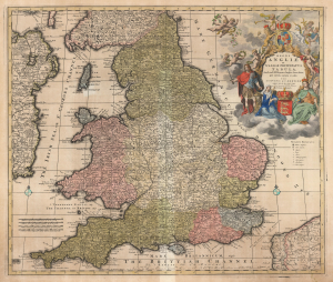
Regni Angliae et Walliae Principatus Tabula, divisa in LII Regiones, Anglice Shire dictas, prae coeteris correcta et edita per I. Covens et C. Mortier Amstelo-Batavum.
$650.00
Acquire
- Digital Map Information
- Suitable for large format printing
- DPI: 600
- File Size: 68.76 MB
- File Type: ZIP / TIFF
- ICC color profile embedded
- Delivered instantly via download link
This is Carel Allard's 1697 map of England and Wales, in its 1725 Covens and Mortier edition. Between the superb engraving of the map and its ornate cartouches, it is one of the most richly decorative maps of England produced in that era. (more details)