
Alt, Wilhelm

Wilhelm Alt (fl. c. 1827 – 1882) was a German cartographer associated with Justus Perthes, based in Gotha. He is credited as the creator of over one hundred maps published by Perthes, especially those in the atlases of Karl Spruner von Merz, Adolf Stieler, and Heinrich Berghaus, though little is known about his life and training.
South Americans complex linguistic landscape.
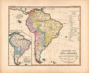
Ethnographische Karte von Süd-Amerika...
$375.00
Acquire
- Digital Map Information
- Suitable for large format printing
- DPI: 600
- File Size: 31.91 MB
- File Type: ZIP / TIFF
- ICC color profile embedded
- Delivered instantly via download link
A fascinating 1847 ethno-linguistic map of South America by Wilhelm Alt for Berghaus' Physikalischer Atlas, a landmark achievement in German cartography. It reflects the intellectual environment of the mid-19th century and, along with the entire atlas, can be regarded as an early example of cartographic representation of social science research. (more details)