
Barich, Carl

Carl Barich (1859 – 1931) was a German cartographer, often in the employ of August Heinrich Petermann, who was involved in the production of a large number of maps, primarily of India, China, and Africa, many of them for Petermanns Geographische Mitteilungen.
Pundits on the 'roof of the world'.
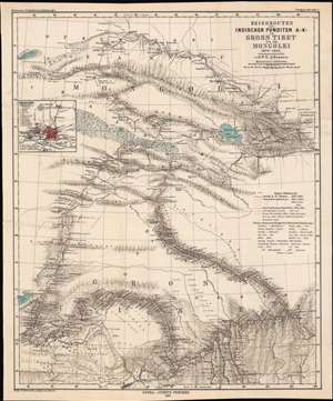
Reiserouten des Indischen Punditen A - K - in Gross Tibet und der Mongolei 1879 - 1882.
$400.00
Acquire
- Digital Map Information
- Suitable for large format printing
- File Size: 22.03 MB
- File Type: ZIP / TIFF
- ICC color profile embedded
- Delivered instantly via download link
This is an 1885 map of expeditions in western China compiled by G.W.E. Atkinson. The map depicts much of today's Qinghai Province and Tibetan Autonomous Region. The map is based not only upon European expeditions, but also those of the Pundits, or Pandits - Indian and / or Tibetan explorers working secretly for the British. (more details)