
Bateman, John

John Bateman (fl. 1804 – 1825) was a British copperplate printer, map, and chart engraver active in London during the early part of the 19th century. Bateman is best known for his maps and charts, especially of the East Indies engraved for James Horsburgh and published between 1804 and 1825. He appears to have spent time in the East Indies with records documenting him in Calcutta as early in 1799 and may have befriended Horsburgh there. Some have speculated that John Bateman is related to Richard Bateman, another map and chart engraver active during roughly the same period.
Weaving through the East Indies.
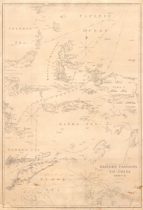
Eastern Passages to China Sheet II.
$800.00
Acquire
- Digital Map Information
- Suitable for large format printing
- File Size: MB
- File Type: ZIP / TIFF
- ICC color profile embedded
- Delivered instantly via download link
A significant blueback nautical chart of a portion of the East Indies (Indonesia) including Timor, the Maluku Islands, and the Banda Sea, originally prepared in 1826 by James Horsburgh and here updated to 1849. As one of the great hydrographers of his day, Horsburgh's charts of the East Indies were among the first detailed nautical charts of these waters, providing essential information for navigators, particularly those working in the China trade. (more details)