
Baudin, Nicolas Thomas
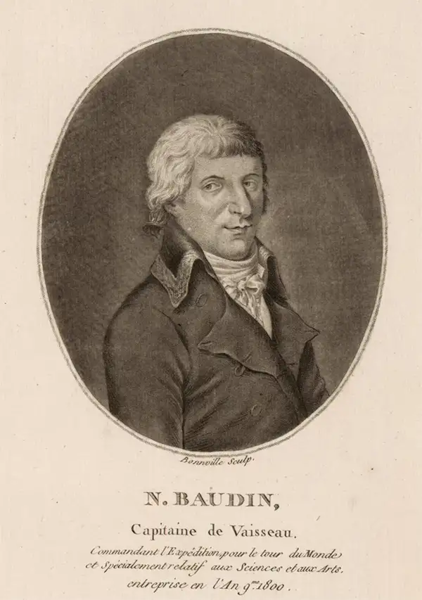
Nicolas Thomas Baudin (February 17, 1754 - September 16, 1803) was a French naval officer, cartographer, naturalist, and explorer whose voyages made major contributions to the scientific study and mapping of Australia and the wider Indo-Pacific. Born on the Île de Ré into a merchant family, he went to sea at a young age, served in the merchant marine, joined the French Royal Navy as a cadet in 1774, and fought during the American Revolutionary War (1775 - 1783). However, his non-aristocratic origins limited his advancement in the officer corps. After returning to commercial service, he developed expertise in transporting living plants and animals. He commanded natural-history expeditions to the Indian Ocean and Caribbean, including voyages associated with the Austrian imperial gardens at Schönbrunn and, from 1796 to 1798, the French Muséum National d'Histoire Naturelle; these expeditions returned valuable collections of plants, birds, insects, and other specimens. Reinstated in the French Navy as a captain, Baudin secured Napoleon Bonaparte's approval to lead an ambitious scientific expedition to the southern lands aboard the corvettes Géographe and Naturaliste, which departed Le Havre in October 1800 with an unusually large company of naturalists, artists, hydrographers, and gardeners. Between 1801 and 1803, the expedition surveyed extensive portions of the western, northern, southern, and southeastern Australian coasts, visited Timor and Tasmania, documented indigenous peoples, and gathered tens of thousands of zoological and botanical specimens, many previously unknown to European science. In April 1802, Baudin encountered the British navigator Matthew Flinders at South Australia's Encounter Bay; despite their countries' political rivalry, the two commanders exchanged information peacefully. Baudin's leadership was hampered by illness, deaths, desertions, and inadequate supplies, as well as bitter disputes with several officers and scientists, particularly François Péron. Suffering from tuberculosis, Baudin died at Île de France, now Mauritius, on September 16, 1803, before the expedition returned to France. Its published narrative, prepared by Péron and later completed by Louis de Freycinet (1799 - 1841), largely omitted or disparaged its deceased commander, obscuring his achievements for generations. Modern scholarship has restored Baudin's reputation, recognizing that his expedition produced some of the earliest detailed charts of large stretches of Australia, assembled one of the richest natural-history collections of its age, and left an exceptional visual and written record of Australian landscapes, wildlife, and indigenous communities.
First Full Map of Australia, and the First to name Sydney.
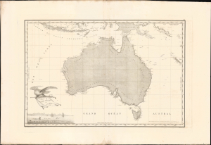
Carte Generale de la Nouvelle Hollande dressee par M L Freycinet Commandant La Goelette, Le Casuarina an 1808.
$8,500.00
Acquire
- Digital Map Information
- Suitable for large format printing
- Full resolution TIFF file
- ICC color profile embedded
- Delivered instantly via download link
This landmark 1811 map of Australia by French explorer and cartographer Louis de Freycinet is celebrated as the first published map to depict the continent's complete coastline and the first to identify Sydney by name. Based on surveys conducted during Nicolas Baudin's French expedition to Australia aboard the Géographe and Naturaliste (1801 - 1803), it presents the continent as Nouvelle Hollande and preserves the expedition's politically charged French nomenclature, including Terre Napoléon. Issued three years before Matthew Flinders' competing map, Freycinet's chart represents a defining achievement in the exploration, mapping and naming of Australia. (more details)
First map of South Australia: politically charged French toponymy.
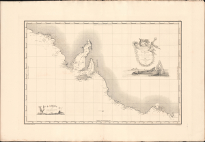
Carte Générale de al Terre Napoléon (À la Nouvelle Holland.)
$3,000.00
Acquire
- Digital Map Information
- Suitable for large format printing
- Full resolution TIFF file
- ICC color profile embedded
- Delivered instantly via download link
This landmark 1811 map of South Australia, including modern-day Adelaide and Melbourne, by French explorer and cartographer Louis de Freycinet. Based on surveys conducted during Nicolas Baudin's expedition to Australia aboard the Géographe and Naturaliste (1801 - 1803), it presents South Australia with politically charged French nomenclature, including, as here, Terre Napoléon. Issued three years before Matthew Flinders' competing map, Freycinet's chart represents a defining achievement in the exploration, mapping and naming of South Australia. (more details)