
Bauzá y Cañas, Felipe
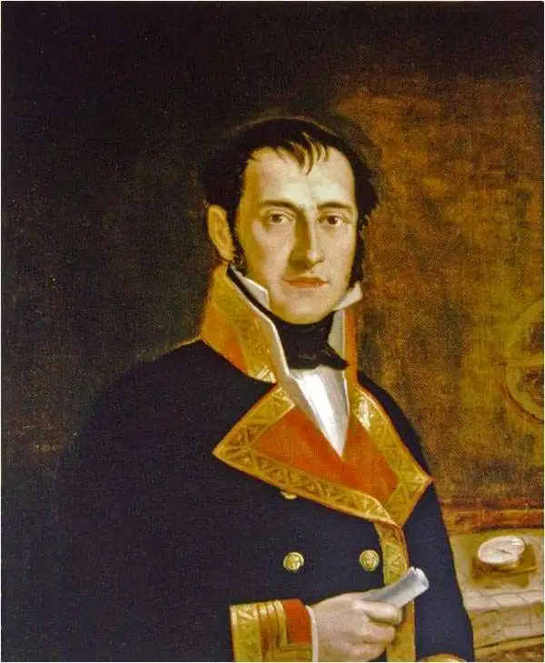
Felipe Bauzá y Cañas (February 17, 1764 - March 3, 1834) was a Spanish cartographer, navigator, and naval officer active in the late 18th and early 19th centuries. Bauzá was born on the Balearic Islands in the Mallorcan city of Palma. He attended the Spanish maritime college in Cartagena, Spain. He saw action during the Siege of Gibraltar (1779 - 1782), the capture of Port Mahón, and a campaign against the Moors (1783 - 1784). Exhibiting a proficiency in mathematics and draftsmanship, he subsequently trained as a hydrographer and cartographer under Vicente Tofiño (1732 – 1795), the premier Spanish nautical chartmaker of the day. Bauzá was the head cartographer on the Malaspina Expedition (1789 - 1794) to the Americas, Oceania, and Australasia. From 1797, he worked with the Depósito Hidrográfico / Dirección Hidrografica in Madrid, becoming head of said organization in 1815. Renowned as a cartographer, he was honored with the Russian Cross of St. Vladimir in 1816 and was elected a Foreign Member of the Royal Society of London in 1819. From about 1800, he began assembling a personal collection of maps and charts intended to form the backdrop of a series of definitive maps of Latin America. Political fate intervened with his plan. Bauzá was a supporter and leader of the of Rafael de Riego Revolution in 1820, and served the Cortes Generales during the Trienio Liberal ('Three Liberal Years', 1820 - 1823), as the deputy for Mallorca. After the fall of that regime, in 1823, he was sentenced to death by King Ferdinand VII. Bauzá fled to England in that year, taking with him his nautical charts and other geographical source materials. Bauzá and his family struggled in London, attempting to support themselves by publishing his cartography and selling parts of his collection to the British Admiralty's Hydrographic Office. His death sentence was finally commuted in 1833, but before he could return to Spain, he died of a brain hemorrhage. He family was left in destitution and his widow Teresa Rivera y Bauzá, made ends meet by selling his map collections. Some went to foreign governments (Venezuela) but most are now part of the Bauzá collection in the British Library.
Spain's Answer to Cook and Laperouse.
$1,200.00
Acquire
- Digital Map Information
- Suitable for large format printing
- Full resolution TIFF file
- ICC color profile embedded
- Delivered instantly via download link
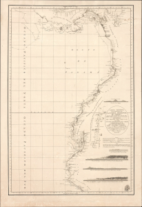
This is an 1800 maritime map or nautical chart of the northern part of the Pacific Coast of South America, prepared by Felipe Bauzá y Cañas and published by the Deposito Hidrografico (Direccion Hidrografía). Bauzá has been the main hydrographer on the Alexandro Malaspina Expedition (1789 - 1794), a Spanish effort to chart the western coast of America and explore the Pacific Ocean, akin to the slightly earlier British and French voyages led by James Cook and Lapérouse, respectively. (more details)
Rare English edition of a Rarer Spanish Chart.
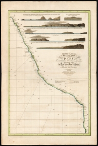
Spherical chart of part of the coast of Peru, from the Parallel of 7.° to 21.° 45.' South Latititude; Surveyed and Drawn by Order of the King of Spain in the year 1790, By Officers of the Royal Navy.
$950.00
Acquire
- Digital Map Information
- Suitable for large format printing
- Full resolution TIFF file
- ICC color profile embedded
- Delivered instantly via download link
This beautiful, rare nautical map of the coast of Peru was printed in 1805 by William Faden. It is based on the elusive chart of Felipe Bauzá y Cañas, who attended the Alexandro Malaspina Expedition (1789 - 1794) on its 1790 exploration of this coast. (more details)
Charting Caribbean Waters.
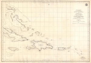
Carta Esferica que Comprehende una Parte de las Islas Antillas, las de Puerto Rico, Santo Domingo, Jamayca y Cuba con los Bancos y Canales Adyacentes.
$1,600.00
Acquire
- Digital Map Information
- Suitable for large format printing
- DPI: 600
- File Size: 57.85 MB
- File Type: ZIP / TIFF
- ICC color profile embedded
- Delivered instantly via download link
An impressive large-format nautical chart, produced in 1815 by the Spanish Dirección Hidrografía, covering the waters off the Greater Antilles and surrounding islands, taking in Cuba, the Bahamas, Hispaniola, Jamaica, Puerto Rico, the Virgin Islands, and Guadeloupe. (more details)