1805 William Faden Nautical Chart of Coastal Peru
Peru-faden-1805$950.00


Title
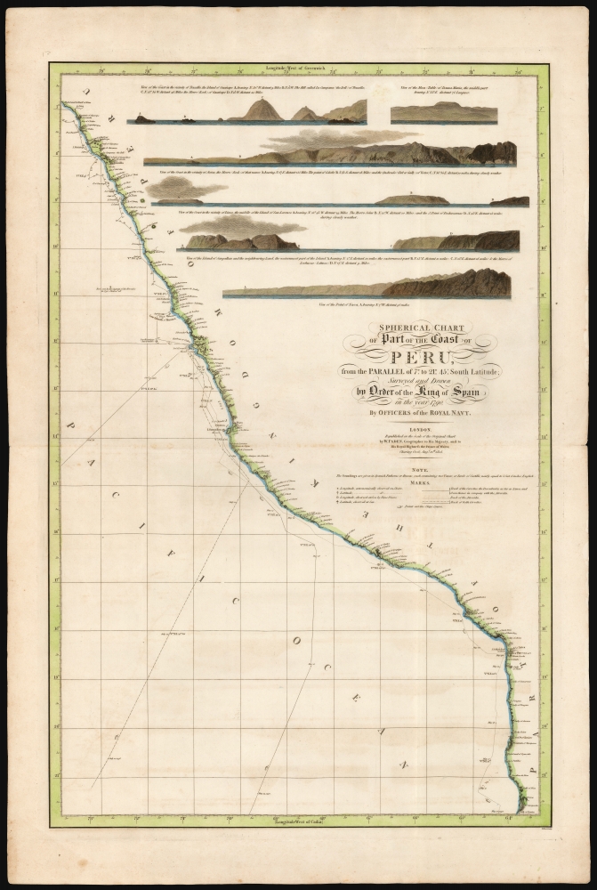
Spherical chart of part of the coast of Peru, from the Parallel of 7.° to 21.° 45.' South Latititude; Surveyed and Drawn by Order of the King of Spain in the year 1790, By Officers of the Royal Navy.
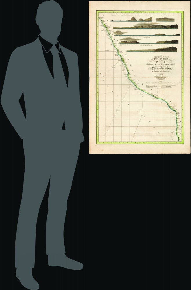
1805 (dated) 33.5 x 22 in (85.09 x 55.88 cm) 1 : 2150000
1805 (dated) 33.5 x 22 in (85.09 x 55.88 cm) 1 : 2150000
Description
This beautiful, rare nautical map of the coast of Peru was printed in 1805 by William Faden. It is based on the elusive chart of Felipe Bauzá y Cañas, who attended the Alexandro Malaspina Expedition (1789 - 1794) on its 1790 exploration of this coast.
Due both his political disfavor and the economic constraints of Spain's war with revolutionary France, Malaspina's account remained unpublished. Nonetheless, several charts based upon the expedition's discoveries were issued by the Dirección de Hydrographia, including the source of this map, Felipe Bauzá's 1798 Carta Esferica de una Parte de la Costa del Peru.
A Closer Look
The nautical chart details the Pacific coast of South America from the vicinity of Chiclayo, Peru to south of Iquique, Chile. The tracks of Malaspina's two corvettes, the Descubierta and the Atrevida, are marked. Six coastal profile views are included in the upper right. Another notation is added from a different source: a rock sighted in 1792 by the captain of the Hercules, a West Indiaman converted to a whaling ship. 1792 would have been her first whaling voyage.Malaspina Expedition
Setting off from Cadiz in 1789, the five-year Malaspina Expedition was the most important Spanish voyage of discovery of the 18th century. Aboard the two corvettes, Malaspina and his subordinate José de Bustamante y Guerra sailed from Spain to the Pacific, surveying both the physical coasts and the political landscape of the Spanish Empire in America and the Philippines. During the leg depicted on the present chart, the two ships were sailing separately; they would rejoin in Mexico in March 1790. After further exploration of the Pacific, from Nootka to Manila to Australia, the fleet returned to Cadiz in September 1793.Malaspina's Exile and Silencing
On his return, Malaspina was well-received by King Charles IV and Prime Minister Manuel de Godor, who promoted him to fleet-brigadier. But when he submitted his political review of the Empire to the government, it was deemed politically volatile for his recommendation that Spain free its colonies - among other absurdities! - and he was not permitted to publish. Malaspina complained vehemently in Madrid newspapers, whilst joining in a conspiracy to oust Godoy. He was accused of his role in the conspiracy, stripped of rank, and imprisoned from 1796 to 1802. When he was freed - partially under pressure from Napoleon - he was exiled from Spain.Due both his political disfavor and the economic constraints of Spain's war with revolutionary France, Malaspina's account remained unpublished. Nonetheless, several charts based upon the expedition's discoveries were issued by the Dirección de Hydrographia, including the source of this map, Felipe Bauzá's 1798 Carta Esferica de una Parte de la Costa del Peru.
Publication History and Census
This map was engraved on behalf of William Faden for separate publication in 1805. It is rare on the market, and appears in only two institutions in OCLC: Princeton and the Clements Library.CartographerS
William Faden (July 11, 1749 - March 21, 1836) was a Scottish cartographer and map publisher of the late 18th century. Faden was born in London. His father, William MacFaden, was a well-known London printer and publisher of The Literary Magazine. During the Jacobite Rebellion (1745 - 1746), MacFaden changed his family name to Faden, to avoid anti-Scottish sentiment. Faden apprenticed under the engraver James Wigley (1700 - 1782), attaining his freedom in 1771 - in the same year that Thomas Jefferys Sr. died. While Thomas Jefferys Sr. was an important and masterful mapmaker, he was a terrible businessman, and his son, Jefferys Jr., had little interest in building on his father's legacy. MacFaden, perhaps recognizing an opportunity, purchased his son a partnership in the Jefferys firm, which subsequently traded as 'Faden and Jefferys'. Jefferys Jr. also inherited Jefferys Sr.'s title, 'Geographer to the King and to the Prince of Wales'. With little interest in cartography or map publishing, Jefferys Jr. increasingly took a back seat to Faden, and by 1776, he had withdrawn from day-to-day management, although he retained his financial stake. The American Revolutionary War (1775 - 1783) proved to be a boom for the young 'Geographer to the King', who leveraged existing materials and unpublished manuscript maps to which he had access via his official appointment to publish a wealth of important maps, both for official use and the curious public - this period of prosperity laid the financial underpinning for Faden, who by 1783, at the end of the war, acquired full ownership of the firm and removed the Jefferys imprint. In 1801, he engraved and published the first maps for the British Ordnance Survey. By 1822, Faden published over 350 maps, atlases, and military plans. He retired in 1823, selling his plates to James Wyld Sr. Faden died in 1836. More by this mapmaker...
Felipe Bauzá y Cañas (February 17, 1764 - March 3, 1834) was a Spanish cartographer, navigator, and naval officer active in the late 18th and early 19th centuries. Bauzá was born on the Balearic Islands in the Mallorcan city of Palma. He attended the Spanish maritime college in Cartagena, Spain. He saw action during the Siege of Gibraltar (1779 - 1782), the capture of Port Mahón, and a campaign against the Moors (1783 - 1784). Exhibiting a proficiency in mathematics and draftsmanship, he subsequently trained as a hydrographer and cartographer under Vicente Tofiño (1732 – 1795), the premier Spanish nautical chartmaker of the day. Bauzá was the head cartographer on the Malaspina Expedition (1789 - 1794) to the Americas, Oceania, and Australasia. From 1797, he worked with the Depósito Hidrográfico / Dirección Hidrografica in Madrid, becoming head of said organization in 1815. Renowned as a cartographer, he was honored with the Russian Cross of St. Vladimir in 1816 and was elected a Foreign Member of the Royal Society of London in 1819. From about 1800, he began assembling a personal collection of maps and charts intended to form the backdrop of a series of definitive maps of Latin America. Political fate intervened with his plan. Bauzá was a supporter and leader of the of Rafael de Riego Revolution in 1920, and served the Cortes Generales during the Trienio Liberal ('Three Liberal Years', 1820 - 1823), as the deputy for Mallorca. After the fall of that regime, in 1823, he was sentenced to death by King Ferdinand VII. Bauzá fled to England in that year, taking with him his nautical charts and other geographical source materials. Bauzá and his family struggled in London, attempting to support themselves by publishing his cartography and selling parts of his collection to the British Admiralty's Hydrographic Office. His death sentence was finally commuted in 1833, but before he could return to Spain, he died of a brain hemorrhage. He family was left in destitution and his widow Teresa Rivera y Bauzá, made ends meet by selling his map collections. Some went to foreign governments (Venezuela) but most are not part of the Bauzá collection in the British Library. Learn More...
Condition
Very good. Centerfold reinforced at margin.
References
OCLC 77879427.