
Beers, Frederick William

Frederick William Beers (August 17, 1839 - September 8, 1933) was an American map publisher, cartographer, and surveyor. Beers was born in Maryland, the son of map publisher James Botsford Beers (October 16, 1811 - June 3, 1901), but lived much of his life in New York where he was the chief of the map division and Commissioner of Public Records in Brooklyn. He joined the family business in 1870 and along with his father, published the Farm Line Atlas of the County of Kings and the Atlas of Long Island. He is credited with personally mapping every county in New York State. Frederick worked with his family into the mapmaking trade, including his brother, Charles Henry Beers (November 3, 1813 - March 5, 1892), and nephews Silas Norman Beers (September 3, 1837 - May 12, 1873) and Daniel Glover Beers (October 19, 1841 - February 12, 1913). He retired from the publishing business in 1930, when he was more than 90 years old. He died on September 8, 1933 in Bridgeport, Connecticut.
Civil War era map of Philly!
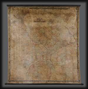
Map of the Vicinity of Philadelphia.
$2,500.00
Acquire
- Digital Map Information
- Suitable for large format printing
- Full resolution TIFF file
- ICC color profile embedded
- Delivered instantly via download link
An impressive 1861 Civil War Era wall map of Philadelphia, Pennsylvania, and vicinity by Silas N. Beers and J. E. Gillette. Centered on Philadelphia, coverage extends roughly 25 miles around in all directions. There is a large inset of Philadelphia in the upper right as well as a city directory along the left side. In addition, there are numerous smaller inset plans detailing surrounding towns and communities. (more details)
Abreast of West Point.
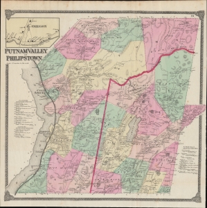
Putnam Valley and Philipstown.
$450.00
Acquire
- Digital Map Information
- Suitable for large format printing
- File Size: 43.1 MB
- File Type: ZIP / TIFF
- ICC color profile embedded
- Delivered instantly via download link
This is F. W. Beers' 1867 hand-colored map of the towns of Putnam Valley and Philipstown, along the Hudson River in Putnam County, New York. (more details)
Heartland of the Hudson Valley.
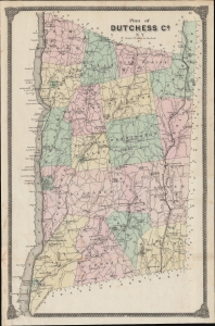
Plan of Dutchess Co. N. Y.
$350.00
Acquire
- Digital Map Information
- Suitable for large format printing
- File Size: 330.2 MB
- File Type: ZIP / TIFF
- ICC color profile embedded
- Delivered instantly via download link
A lovely example of F. W. Beers 1867 map of Dutchess County, New York that appeared in his Atlas of New York and Vicinity from Actual Surveys. This area is known for its scenic beauty, historical significance (especially its association with the Roosevelts), and educational institutions, notably Vassar College. (more details)
Stronghold of the Revolution.
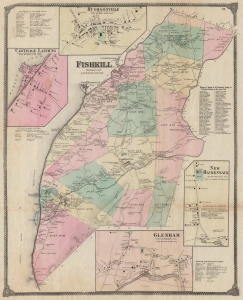
Fishkill Dutchess Co. N.Y.
$400.00
Acquire
- Digital Map Information
- Suitable for large format printing
- File Size: 45.63 MB
- File Type: ZIP / TIFF
- ICC color profile embedded
- Delivered instantly via download link
An example of Frederick W. Beers' 1867 detailed hand-colored map of the town of Fishkill, New York, along the Hudson River. (more details)